I15A Monteview, ID, USA - Earthquake Result Viewer
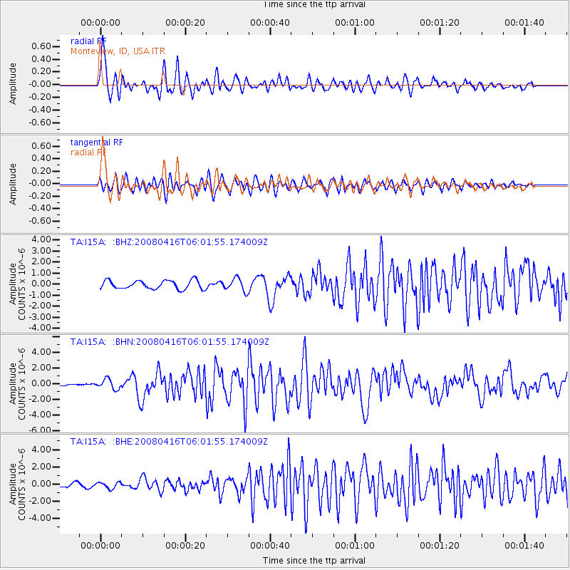
Earthquake location: Andreanof Islands, Aleutian Is.
Earthquake latitude/longitude: 51.9/-179.2
Earthquake time(UTC): 2008/04/16 (107) 05:54:19 GMT
Earthquake Depth: 13 km
Earthquake Magnitude: 6.1 MB, 6.5 MS, 6.6 MW, 6.6 MW
Earthquake Catalog/Contributor: WHDF/NEIC
Network: TA USArray Transportable Network (new EarthScope stations)
Station: I15A Monteview, ID, USA
Lat/Lon: 44.00 N/112.49 W
Elevation: 1470 m
Distance: 43.9 deg
Az: 72.815 deg
Baz: 304.851 deg
Ray Param: 0.072228596
Estimated Moho Depth: 10.0 km
Estimated Crust Vp/Vs: 1.60
Assumed Crust Vp: 6.279 km/s
Estimated Crust Vs: 3.924 km/s
Estimated Crust Poisson's Ratio: 0.18
Radial Match: 86.43876 %
Radial Bump: 400
Transverse Match: 76.83072 %
Transverse Bump: 400
SOD ConfigId: 2504
Insert Time: 2010-03-06 04:03:49.912 +0000
GWidth: 2.5
Max Bumps: 400
Tol: 0.001

Signal To Noise

ChannelStoNSTALTA
TA:I15A: :BHN:20080416T06:01:55.174009Z6.4742396.528937E-71.0084485E-7
TA:I15A: :BHE:20080416T06:01:55.174009Z1.62019753.6284519E-72.239512E-7
TA:I15A: :BHZ:20080416T06:01:55.174009Z1.55844635.91865E-73.7977887E-7
Arrivals
Ps1.0 SECOND
PpPs3.9 SECOND
PsPs/PpSs4.9 SECOND