
I15A Monteview, ID, USA - Earthquake Result Viewer
| ||||||||||||||||||
| ||||||||||||||||||
| ||||||||||||||||||
|
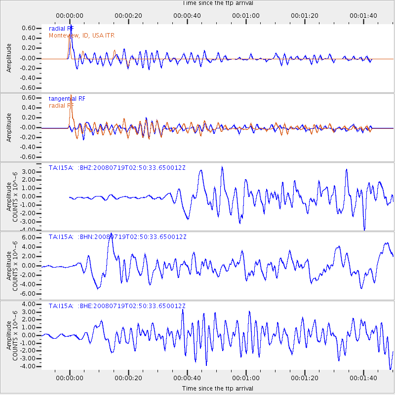
Signal To Noise
| Channel | StoN | STA | LTA |
| TA:I15A: :BHN:20080719T02:50:33.650012Z | 5.217742 | 5.267723E-7 | 1.0095791E-7 |
| TA:I15A: :BHE:20080719T02:50:33.650012Z | 1.9431465 | 2.3372571E-7 | 1.202821E-7 |
| TA:I15A: :BHZ:20080719T02:50:33.650012Z | 1.9543836 | 2.5748727E-7 | 1.3174858E-7 |
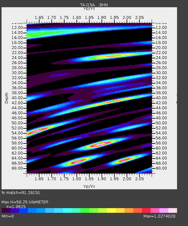
| Arrivals | |
| Ps | 8.5 SECOND |
| PpPs | 26 SECOND |
| PsPs/PpSs | 35 SECOND |

