I15A Monteview, ID, USA - Earthquake Result Viewer
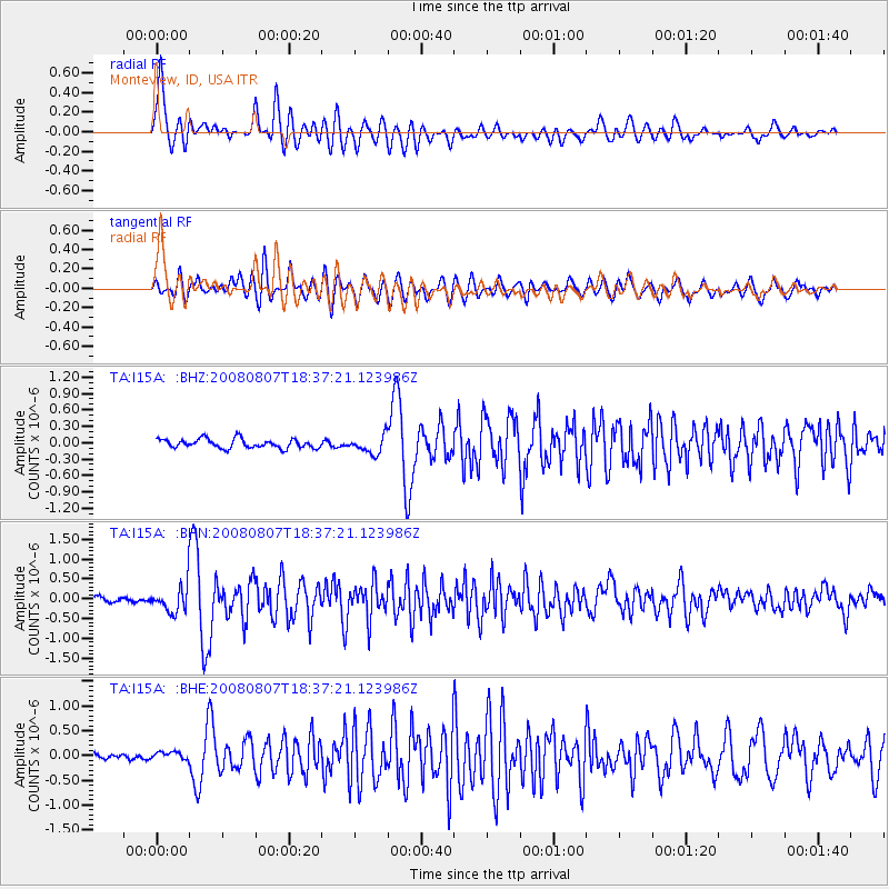
Earthquake location: Andreanof Islands, Aleutian Is.
Earthquake latitude/longitude: 52.2/-175.7
Earthquake time(UTC): 2008/08/07 (220) 18:30:03 GMT
Earthquake Depth: 12 km
Earthquake Magnitude: 5.6 MB, 5.5 MS, 5.8 MW, 5.8 MW
Earthquake Catalog/Contributor: WHDF/NEIC
Network: TA USArray Transportable Network (new EarthScope stations)
Station: I15A Monteview, ID, USA
Lat/Lon: 44.00 N/112.49 W
Elevation: 1470 m
Distance: 41.7 deg
Az: 75.259 deg
Baz: 304.415 deg
Ray Param: 0.073589414
Estimated Moho Depth: 46.0 km
Estimated Crust Vp/Vs: 1.66
Assumed Crust Vp: 6.279 km/s
Estimated Crust Vs: 3.788 km/s
Estimated Crust Poisson's Ratio: 0.21
Radial Match: 85.710495 %
Radial Bump: 400
Transverse Match: 78.91116 %
Transverse Bump: 400
SOD ConfigId: 2504
Insert Time: 2010-03-06 04:04:12.490 +0000
GWidth: 2.5
Max Bumps: 400
Tol: 0.001

Signal To Noise

ChannelStoNSTALTA
TA:I15A: :BHN:20080807T18:37:21.123986Z5.30436233.3964182E-76.4030665E-8
TA:I15A: :BHE:20080807T18:37:21.123986Z0.87131658.078758E-89.2718984E-8
TA:I15A: :BHZ:20080807T18:37:21.123986Z1.96092691.622316E-78.27321E-8
Arrivals
Ps5.2 SECOND
PpPs18 SECOND
PsPs/PpSs23 SECOND