
I15A Monteview, ID, USA - Earthquake Result Viewer
| ||||||||||||||||||
| ||||||||||||||||||
| ||||||||||||||||||
|
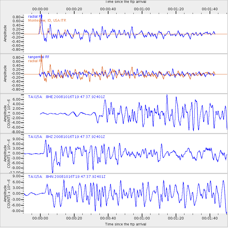
Signal To Noise
| Channel | StoN | STA | LTA |
| TA:I15A: :BHZ:20081016T19:47:37.92401Z | 26.009304 | 3.335655E-6 | 1.2824853E-7 |
| TA:I15A: :BHN:20081016T19:47:37.92401Z | 4.3642755 | 2.043029E-6 | 4.6812562E-7 |
| TA:I15A: :BHE:20081016T19:47:37.92401Z | 4.1559305 | 1.6192212E-6 | 3.8961699E-7 |
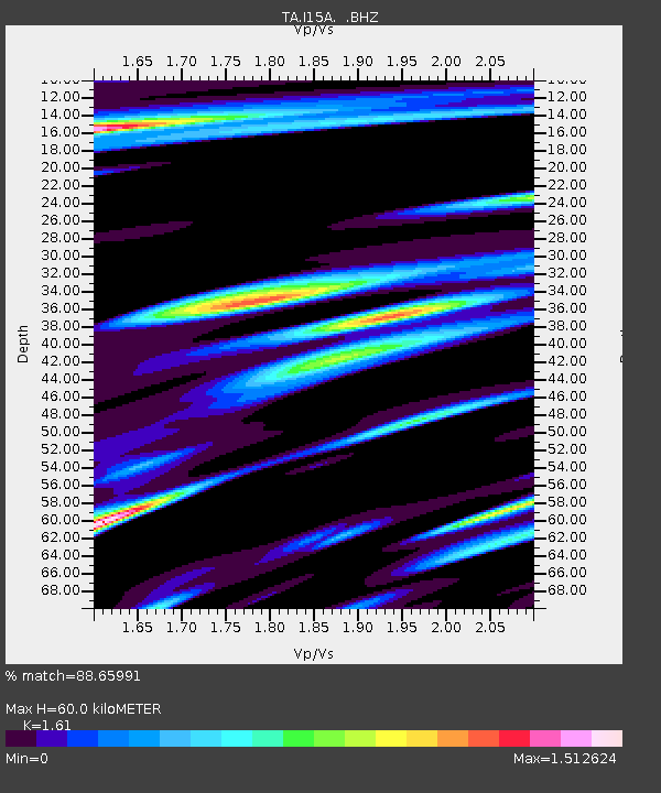
| Arrivals | |
| Ps | 6.3 SECOND |
| PpPs | 23 SECOND |
| PsPs/PpSs | 29 SECOND |

