I15A Monteview, ID, USA - Earthquake Result Viewer
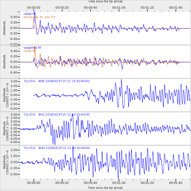
Earthquake location: Kermadec Islands, New Zealand
Earthquake latitude/longitude: -29.8/-177.7
Earthquake time(UTC): 2008/09/29 (273) 15:19:31 GMT
Earthquake Depth: 36 km
Earthquake Magnitude: 6.5 MB, 6.7 MS, 7.0 MW, 7.0 MW
Earthquake Catalog/Contributor: WHDF/NEIC
Network: TA USArray Transportable Network (new EarthScope stations)
Station: I15A Monteview, ID, USA
Lat/Lon: 44.00 N/112.49 W
Elevation: 1470 m
Distance: 94.5 deg
Az: 41.082 deg
Baz: 232.356 deg
Ray Param: 0.041012637
Estimated Moho Depth: 11.5 km
Estimated Crust Vp/Vs: 1.60
Assumed Crust Vp: 6.279 km/s
Estimated Crust Vs: 3.924 km/s
Estimated Crust Poisson's Ratio: 0.18
Radial Match: 84.51598 %
Radial Bump: 400
Transverse Match: 85.52334 %
Transverse Bump: 400
SOD ConfigId: 2560
Insert Time: 2010-03-06 04:04:40.699 +0000
GWidth: 2.5
Max Bumps: 400
Tol: 0.001

Signal To Noise

ChannelStoNSTALTA
TA:I15A: :BHZ:20080929T15:32:16.824009Z4.6907984.0184682E-78.566705E-8
TA:I15A: :BHN:20080929T15:32:16.824009Z1.03897631.560646E-71.5020996E-7
TA:I15A: :BHE:20080929T15:32:16.824009Z1.23964881.8066947E-71.4574248E-7
Arrivals
Ps1.1 SECOND
PpPs4.7 SECOND
PsPs/PpSs5.8 SECOND