You are here: Home > Network List > II - Global Seismograph Network (GSN - IRIS/IDA) Stations List
> Station WRAB Tennant Creek, NT, Australia > Earthquake Result Viewer
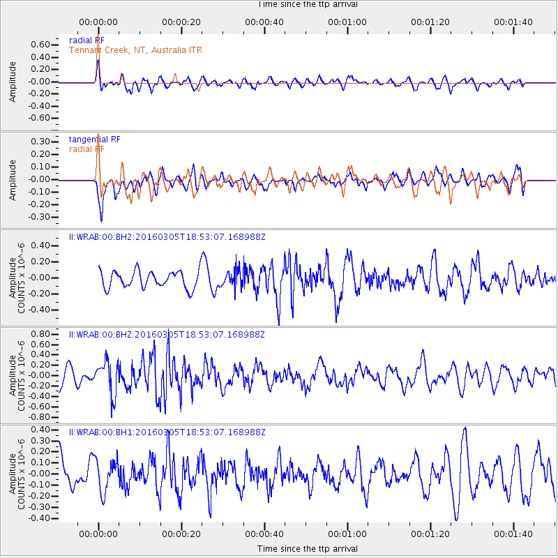
WRAB Tennant Creek, NT, Australia - Earthquake Result Viewer
*The percent match for this event was below the threshold and hence no stack was calculated.
| Earthquake location: |
South Of Kermadec Islands |
| Earthquake latitude/longitude: |
-32.9/-178.2 |
| Earthquake time(UTC): |
2016/03/05 (065) 18:45:30 GMT |
| Earthquake Depth: |
10 km |
| Earthquake Magnitude: |
5.5 MB |
| Earthquake Catalog/Contributor: |
NEIC PDE/NEIC COMCAT |
|
| Network: |
II Global Seismograph Network (GSN - IRIS/IDA) |
| Station: |
WRAB Tennant Creek, NT, Australia |
| Lat/Lon: |
19.93 S/134.36 E |
| Elevation: |
366 m |
|
| Distance: |
44.1 deg |
| Az: |
274.877 deg |
| Baz: |
117.03 deg |
| Ray Param: |
$rayparam |
*The percent match for this event was below the threshold and hence was not used in the summary stack. |
|
| Radial Match: |
57.53436 % |
| Radial Bump: |
400 |
| Transverse Match: |
55.48518 % |
| Transverse Bump: |
400 |
| SOD ConfigId: |
1427151 |
| Insert Time: |
2016-03-19 19:23:20.455 +0000 |
| GWidth: |
2.5 |
| Max Bumps: |
400 |
| Tol: |
0.001 |
|
Signal To Noise
| Channel | StoN | STA | LTA |
| II:WRAB:00:BHZ:20160305T18:53:07.168988Z | 2.0631387 | 3.2638445E-7 | 1.5819802E-7 |
| II:WRAB:00:BH1:20160305T18:53:07.168988Z | 1.1530653 | 1.443073E-7 | 1.25151E-7 |
| II:WRAB:00:BH2:20160305T18:53:07.168988Z | 0.92100877 | 9.762512E-8 | 1.05998026E-7 |
| Arrivals |
| Ps | |
| PpPs | |
| PsPs/PpSs | |


