You are here: Home > Network List > TA - USArray Transportable Network (new EarthScope stations) Stations List
> Station I15A Monteview, ID, USA > Earthquake Result Viewer
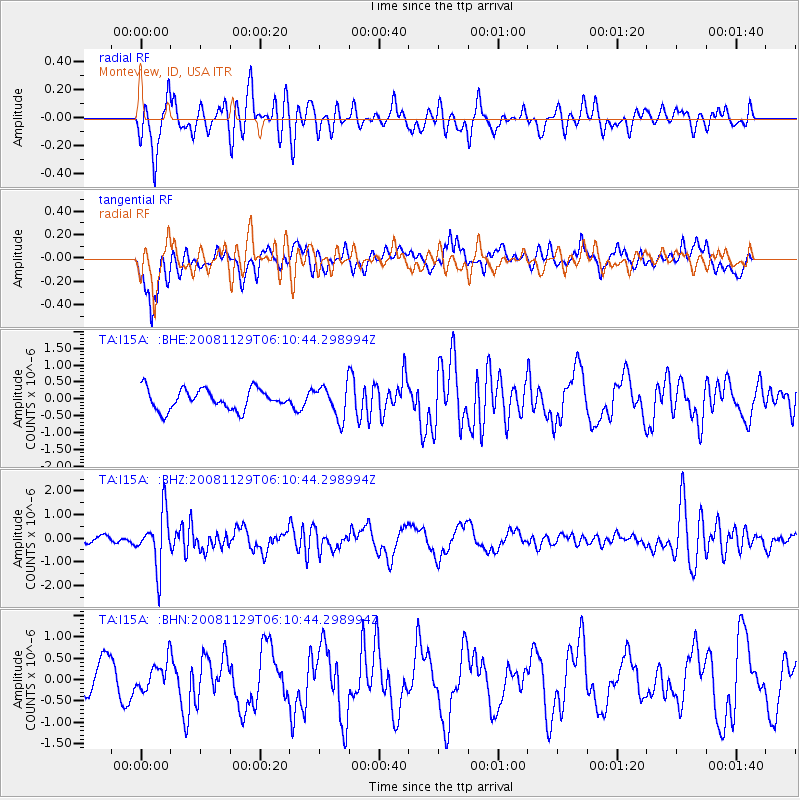
I15A Monteview, ID, USA - Earthquake Result Viewer
*The percent match for this event was below the threshold and hence no stack was calculated.
| Earthquake location: |
Fiji Islands Region |
| Earthquake latitude/longitude: |
-18.7/-177.7 |
| Earthquake time(UTC): |
2008/11/29 (334) 05:59:16 GMT |
| Earthquake Depth: |
386 km |
| Earthquake Magnitude: |
5.7 MB, 6.0 MW, 5.9 MW |
| Earthquake Catalog/Contributor: |
WHDF/NEIC |
|
| Network: |
TA USArray Transportable Network (new EarthScope stations) |
| Station: |
I15A Monteview, ID, USA |
| Lat/Lon: |
44.00 N/112.49 W |
| Elevation: |
1470 m |
|
| Distance: |
86.2 deg |
| Az: |
41.049 deg |
| Baz: |
239.602 deg |
| Ray Param: |
$rayparam |
*The percent match for this event was below the threshold and hence was not used in the summary stack. |
|
| Radial Match: |
57.655407 % |
| Radial Bump: |
400 |
| Transverse Match: |
55.825943 % |
| Transverse Bump: |
400 |
| SOD ConfigId: |
2658 |
| Insert Time: |
2010-03-06 04:08:09.017 +0000 |
| GWidth: |
2.5 |
| Max Bumps: |
400 |
| Tol: |
0.001 |
|
Signal To Noise
| Channel | StoN | STA | LTA |
| TA:I15A: :BHZ:20081129T06:10:44.298994Z | 6.311541 | 1.1223544E-6 | 1.7782573E-7 |
| TA:I15A: :BHN:20081129T06:10:44.298994Z | 0.84497666 | 3.268736E-7 | 3.8684334E-7 |
| TA:I15A: :BHE:20081129T06:10:44.298994Z | 1.6040609 | 4.853311E-7 | 3.02564E-7 |
| Arrivals |
| Ps | |
| PpPs | |
| PsPs/PpSs | |


