You are here: Home > Network List > TA - USArray Transportable Network (new EarthScope stations) Stations List
> Station C16K Lisburne Hills, AK, USA > Earthquake Result Viewer
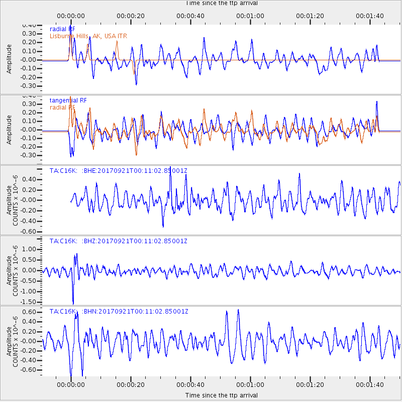
C16K Lisburne Hills, AK, USA - Earthquake Result Viewer
*The percent match for this event was below the threshold and hence no stack was calculated.
| Earthquake location: |
Java, Indonesia |
| Earthquake latitude/longitude: |
-6.1/113.0 |
| Earthquake time(UTC): |
2017/09/20 (263) 23:59:24 GMT |
| Earthquake Depth: |
589 km |
| Earthquake Magnitude: |
5.7 Mww |
| Earthquake Catalog/Contributor: |
NEIC PDE/us |
|
| Network: |
TA USArray Transportable Network (new EarthScope stations) |
| Station: |
C16K Lisburne Hills, AK, USA |
| Lat/Lon: |
68.27 N/165.34 W |
| Elevation: |
102 m |
|
| Distance: |
92.6 deg |
| Az: |
21.638 deg |
| Baz: |
259.997 deg |
| Ray Param: |
$rayparam |
*The percent match for this event was below the threshold and hence was not used in the summary stack. |
|
| Radial Match: |
63.589104 % |
| Radial Bump: |
400 |
| Transverse Match: |
44.31497 % |
| Transverse Bump: |
400 |
| SOD ConfigId: |
13570011 |
| Insert Time: |
2019-04-28 20:38:00.250 +0000 |
| GWidth: |
2.5 |
| Max Bumps: |
400 |
| Tol: |
0.001 |
|
Signal To Noise
| Channel | StoN | STA | LTA |
| TA:C16K: :BHZ:20170921T00:11:02.85001Z | 2.9768143 | 4.7608884E-7 | 1.5993233E-7 |
| TA:C16K: :BHN:20170921T00:11:02.85001Z | 3.2210054 | 4.0779682E-7 | 1.2660544E-7 |
| TA:C16K: :BHE:20170921T00:11:02.85001Z | 1.7828444 | 2.4012604E-7 | 1.3468704E-7 |
| Arrivals |
| Ps | |
| PpPs | |
| PsPs/PpSs | |


