You are here: Home > Network List > TA - USArray Transportable Network (new EarthScope stations) Stations List
> Station G16K Koyuk River, AK, USA > Earthquake Result Viewer
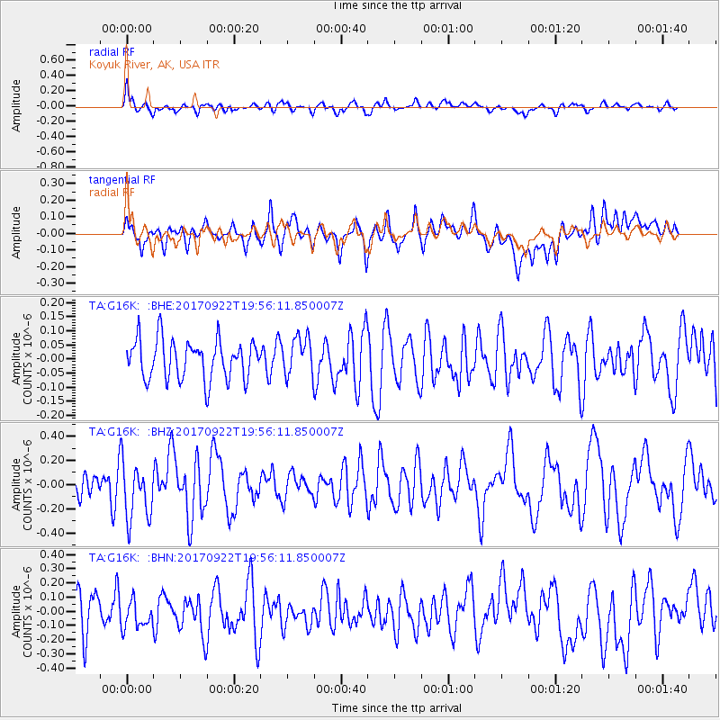
G16K Koyuk River, AK, USA - Earthquake Result Viewer
*The percent match for this event was below the threshold and hence no stack was calculated.
| Earthquake location: |
Off Coast Of Northern California |
| Earthquake latitude/longitude: |
40.4/-126.8 |
| Earthquake time(UTC): |
2017/09/22 (265) 19:50:15 GMT |
| Earthquake Depth: |
11 km |
| Earthquake Magnitude: |
5.6 Mw |
| Earthquake Catalog/Contributor: |
NEIC PDE/us |
|
| Network: |
TA USArray Transportable Network (new EarthScope stations) |
| Station: |
G16K Koyuk River, AK, USA |
| Lat/Lon: |
65.39 N/162.35 W |
| Elevation: |
169 m |
|
| Distance: |
32.2 deg |
| Az: |
332.798 deg |
| Baz: |
123.53 deg |
| Ray Param: |
$rayparam |
*The percent match for this event was below the threshold and hence was not used in the summary stack. |
|
| Radial Match: |
62.022392 % |
| Radial Bump: |
400 |
| Transverse Match: |
54.337383 % |
| Transverse Bump: |
400 |
| SOD ConfigId: |
13570011 |
| Insert Time: |
2019-04-28 20:47:02.647 +0000 |
| GWidth: |
2.5 |
| Max Bumps: |
400 |
| Tol: |
0.001 |
|
Signal To Noise
| Channel | StoN | STA | LTA |
| TA:G16K: :BHZ:20170922T19:56:11.850007Z | 2.469243 | 2.309825E-7 | 9.354385E-8 |
| TA:G16K: :BHN:20170922T19:56:11.850007Z | 0.85157937 | 9.974932E-8 | 1.171345E-7 |
| TA:G16K: :BHE:20170922T19:56:11.850007Z | 0.97678816 | 6.813839E-8 | 6.975759E-8 |
| Arrivals |
| Ps | |
| PpPs | |
| PsPs/PpSs | |


