You are here: Home > Network List > TA - USArray Transportable Network (new EarthScope stations) Stations List
> Station E20K Nigu River, AK, USA > Earthquake Result Viewer
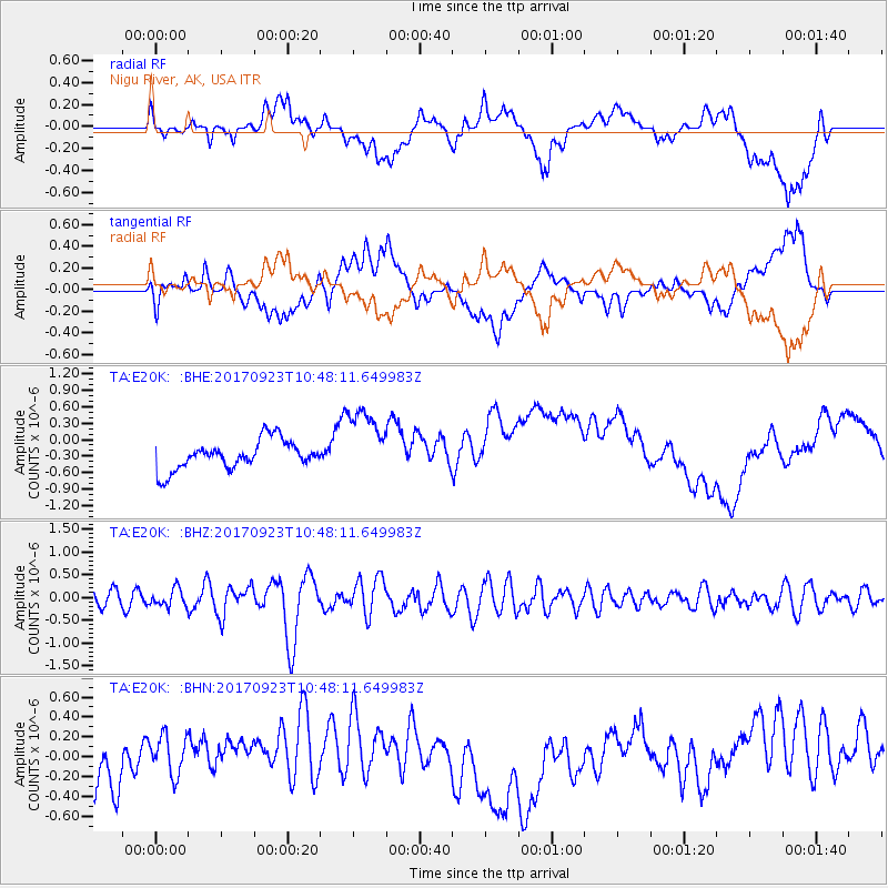
E20K Nigu River, AK, USA - Earthquake Result Viewer
*The percent match for this event was below the threshold and hence no stack was calculated.
| Earthquake location: |
Near Coast Of Oaxaca, Mexico |
| Earthquake latitude/longitude: |
15.7/-94.2 |
| Earthquake time(UTC): |
2017/09/23 (266) 10:38:08 GMT |
| Earthquake Depth: |
74 km |
| Earthquake Magnitude: |
5.8 Mww |
| Earthquake Catalog/Contributor: |
NEIC PDE/us |
|
| Network: |
TA USArray Transportable Network (new EarthScope stations) |
| Station: |
E20K Nigu River, AK, USA |
| Lat/Lon: |
68.26 N/156.19 W |
| Elevation: |
866 m |
|
| Distance: |
65.3 deg |
| Az: |
338.765 deg |
| Baz: |
110.562 deg |
| Ray Param: |
$rayparam |
*The percent match for this event was below the threshold and hence was not used in the summary stack. |
|
| Radial Match: |
36.275265 % |
| Radial Bump: |
400 |
| Transverse Match: |
46.96631 % |
| Transverse Bump: |
400 |
| SOD ConfigId: |
13570011 |
| Insert Time: |
2019-04-28 20:52:42.873 +0000 |
| GWidth: |
2.5 |
| Max Bumps: |
400 |
| Tol: |
0.001 |
|
Signal To Noise
| Channel | StoN | STA | LTA |
| TA:E20K: :BHZ:20170923T10:48:11.649983Z | 1.1059883 | 1.9353817E-7 | 1.7499116E-7 |
| TA:E20K: :BHN:20170923T10:48:11.649983Z | 1.2974898 | 2.5880374E-7 | 1.9946495E-7 |
| TA:E20K: :BHE:20170923T10:48:11.649983Z | 2.4684172 | 6.213014E-7 | 2.5170033E-7 |
| Arrivals |
| Ps | |
| PpPs | |
| PsPs/PpSs | |


