You are here: Home > Network List > AV - Alaska Volcano Observatory Stations List
> Station AMKA Regional Station, Amchitka Island, Alaska > Earthquake Result Viewer
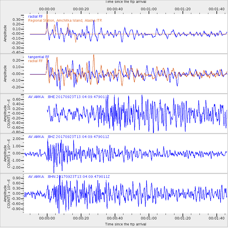
AMKA Regional Station, Amchitka Island, Alaska - Earthquake Result Viewer
*The percent match for this event was below the threshold and hence no stack was calculated.
| Earthquake location: |
Oaxaca, Mexico |
| Earthquake latitude/longitude: |
16.7/-94.9 |
| Earthquake time(UTC): |
2017/09/23 (266) 12:53:02 GMT |
| Earthquake Depth: |
9.1 km |
| Earthquake Magnitude: |
6.1 Mww |
| Earthquake Catalog/Contributor: |
NEIC PDE/us |
|
| Network: |
AV Alaska Volcano Observatory |
| Station: |
AMKA Regional Station, Amchitka Island, Alaska |
| Lat/Lon: |
51.38 N/179.30 E |
| Elevation: |
116 m |
|
| Distance: |
74.5 deg |
| Az: |
319.558 deg |
| Baz: |
82.594 deg |
| Ray Param: |
$rayparam |
*The percent match for this event was below the threshold and hence was not used in the summary stack. |
|
| Radial Match: |
69.48233 % |
| Radial Bump: |
400 |
| Transverse Match: |
64.64506 % |
| Transverse Bump: |
400 |
| SOD ConfigId: |
13570011 |
| Insert Time: |
2019-04-28 20:55:35.472 +0000 |
| GWidth: |
2.5 |
| Max Bumps: |
400 |
| Tol: |
0.001 |
|
Signal To Noise
| Channel | StoN | STA | LTA |
| AV:AMKA: :BHZ:20170923T13:04:09.479011Z | 7.2302003 | 9.4099886E-7 | 1.3014838E-7 |
| AV:AMKA: :BHN:20170923T13:04:09.479011Z | 1.7170761 | 2.715501E-7 | 1.5814682E-7 |
| AV:AMKA: :BHE:20170923T13:04:09.479011Z | 1.5738562 | 2.6900244E-7 | 1.7091932E-7 |
| Arrivals |
| Ps | |
| PpPs | |
| PsPs/PpSs | |


