You are here: Home > Network List > TA - USArray Transportable Network (new EarthScope stations) Stations List
> Station Z20A Nine Sixteen Ranch, Cliff, NM, USA > Earthquake Result Viewer
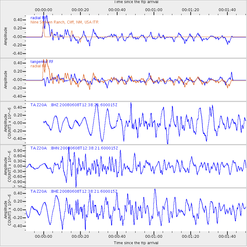
Z20A Nine Sixteen Ranch, Cliff, NM, USA - Earthquake Result Viewer
*The percent match for this event was below the threshold and hence no stack was calculated.
| Earthquake location: |
Southern Greece |
| Earthquake latitude/longitude: |
38.0/21.5 |
| Earthquake time(UTC): |
2008/06/08 (160) 12:25:29 GMT |
| Earthquake Depth: |
16 km |
| Earthquake Magnitude: |
6.2 MB, 6.3 MS, 6.3 MW, 6.3 MW |
| Earthquake Catalog/Contributor: |
WHDF/NEIC |
|
| Network: |
TA USArray Transportable Network (new EarthScope stations) |
| Station: |
Z20A Nine Sixteen Ranch, Cliff, NM, USA |
| Lat/Lon: |
33.11 N/108.59 W |
| Elevation: |
1547 m |
|
| Distance: |
95.4 deg |
| Az: |
319.858 deg |
| Baz: |
37.384 deg |
| Ray Param: |
$rayparam |
*The percent match for this event was below the threshold and hence was not used in the summary stack. |
|
| Radial Match: |
67.764336 % |
| Radial Bump: |
400 |
| Transverse Match: |
47.522022 % |
| Transverse Bump: |
358 |
| SOD ConfigId: |
2504 |
| Insert Time: |
2010-03-06 04:11:41.547 +0000 |
| GWidth: |
2.5 |
| Max Bumps: |
400 |
| Tol: |
0.001 |
|
Signal To Noise
| Channel | StoN | STA | LTA |
| TA:Z20A: :BHN:20080608T12:38:21.600015Z | 1.5223063 | 1.5401412E-7 | 1.0117157E-7 |
| TA:Z20A: :BHE:20080608T12:38:21.600015Z | 1.6060082 | 1.9652767E-7 | 1.2237027E-7 |
| TA:Z20A: :BHZ:20080608T12:38:21.600015Z | 2.9251144 | 3.1464404E-7 | 1.07566414E-7 |
| Arrivals |
| Ps | |
| PpPs | |
| PsPs/PpSs | |


