You are here: Home > Network List > TA - USArray Transportable Network (new EarthScope stations) Stations List
> Station Z20A Nine Sixteen Ranch, Cliff, NM, USA > Earthquake Result Viewer
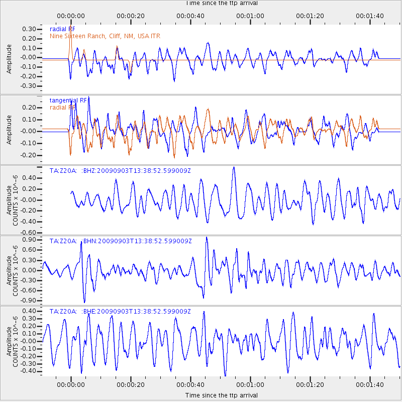
Z20A Nine Sixteen Ranch, Cliff, NM, USA - Earthquake Result Viewer
*The percent match for this event was below the threshold and hence no stack was calculated.
| Earthquake location: |
Kyushu, Japan |
| Earthquake latitude/longitude: |
31.1/130.0 |
| Earthquake time(UTC): |
2009/09/03 (246) 13:26:18 GMT |
| Earthquake Depth: |
166 km |
| Earthquake Magnitude: |
5.9 MB, 6.2 MW, 6.2 MW |
| Earthquake Catalog/Contributor: |
WHDF/NEIC |
|
| Network: |
TA USArray Transportable Network (new EarthScope stations) |
| Station: |
Z20A Nine Sixteen Ranch, Cliff, NM, USA |
| Lat/Lon: |
33.11 N/108.59 W |
| Elevation: |
1547 m |
|
| Distance: |
95.4 deg |
| Az: |
46.032 deg |
| Baz: |
312.668 deg |
| Ray Param: |
$rayparam |
*The percent match for this event was below the threshold and hence was not used in the summary stack. |
|
| Radial Match: |
51.296803 % |
| Radial Bump: |
400 |
| Transverse Match: |
60.168053 % |
| Transverse Bump: |
400 |
| SOD ConfigId: |
2622 |
| Insert Time: |
2010-03-06 04:13:35.735 +0000 |
| GWidth: |
2.5 |
| Max Bumps: |
400 |
| Tol: |
0.001 |
|
Signal To Noise
| Channel | StoN | STA | LTA |
| TA:Z20A: :BHN:20090903T13:38:52.599009Z | 2.59752 | 4.1928215E-7 | 1.6141632E-7 |
| TA:Z20A: :BHE:20090903T13:38:52.599009Z | 1.1567975 | 1.9588865E-7 | 1.6933703E-7 |
| TA:Z20A: :BHZ:20090903T13:38:52.599009Z | 1.0068815 | 1.4711628E-7 | 1.4611082E-7 |
| Arrivals |
| Ps | |
| PpPs | |
| PsPs/PpSs | |


