You are here: Home > Network List > TA - USArray Transportable Network (new EarthScope stations) Stations List
> Station C16K Lisburne Hills, AK, USA > Earthquake Result Viewer
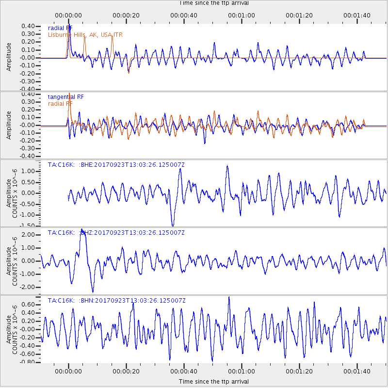
C16K Lisburne Hills, AK, USA - Earthquake Result Viewer
*The percent match for this event was below the threshold and hence no stack was calculated.
| Earthquake location: |
Oaxaca, Mexico |
| Earthquake latitude/longitude: |
16.7/-94.9 |
| Earthquake time(UTC): |
2017/09/23 (266) 12:53:02 GMT |
| Earthquake Depth: |
9.1 km |
| Earthquake Magnitude: |
6.1 Mww |
| Earthquake Catalog/Contributor: |
NEIC PDE/us |
|
| Network: |
TA USArray Transportable Network (new EarthScope stations) |
| Station: |
C16K Lisburne Hills, AK, USA |
| Lat/Lon: |
68.27 N/165.34 W |
| Elevation: |
102 m |
|
| Distance: |
67.3 deg |
| Az: |
337.66 deg |
| Baz: |
101.991 deg |
| Ray Param: |
$rayparam |
*The percent match for this event was below the threshold and hence was not used in the summary stack. |
|
| Radial Match: |
71.57027 % |
| Radial Bump: |
400 |
| Transverse Match: |
64.24261 % |
| Transverse Bump: |
400 |
| SOD ConfigId: |
13570011 |
| Insert Time: |
2019-04-28 21:00:33.954 +0000 |
| GWidth: |
2.5 |
| Max Bumps: |
400 |
| Tol: |
0.001 |
|
Signal To Noise
| Channel | StoN | STA | LTA |
| TA:C16K: :BHZ:20170923T13:03:26.125007Z | 3.7160234 | 1.1966974E-6 | 3.220371E-7 |
| TA:C16K: :BHN:20170923T13:03:26.125007Z | 1.3177073 | 2.9482877E-7 | 2.2374374E-7 |
| TA:C16K: :BHE:20170923T13:03:26.125007Z | 1.0446 | 2.417924E-7 | 2.3146889E-7 |
| Arrivals |
| Ps | |
| PpPs | |
| PsPs/PpSs | |


