You are here: Home > Network List > TA - USArray Transportable Network (new EarthScope stations) Stations List
> Station Z20A Nine Sixteen Ranch, Cliff, NM, USA > Earthquake Result Viewer
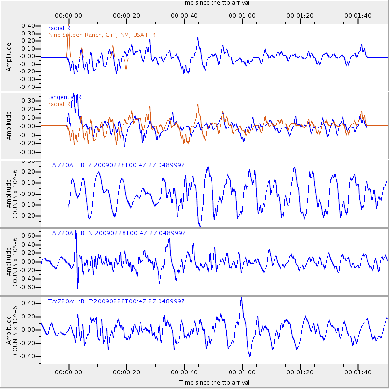
Z20A Nine Sixteen Ranch, Cliff, NM, USA - Earthquake Result Viewer
*The percent match for this event was below the threshold and hence no stack was calculated.
| Earthquake location: |
Hokkaido, Japan Region |
| Earthquake latitude/longitude: |
42.6/142.1 |
| Earthquake time(UTC): |
2009/02/28 (059) 00:35:56 GMT |
| Earthquake Depth: |
105 km |
| Earthquake Magnitude: |
5.5 MB, 5.5 MW, 5.5 MW |
| Earthquake Catalog/Contributor: |
WHDF/NEIC |
|
| Network: |
TA USArray Transportable Network (new EarthScope stations) |
| Station: |
Z20A Nine Sixteen Ranch, Cliff, NM, USA |
| Lat/Lon: |
33.11 N/108.59 W |
| Elevation: |
1547 m |
|
| Distance: |
80.7 deg |
| Az: |
53.386 deg |
| Baz: |
315.085 deg |
| Ray Param: |
$rayparam |
*The percent match for this event was below the threshold and hence was not used in the summary stack. |
|
| Radial Match: |
52.851387 % |
| Radial Bump: |
400 |
| Transverse Match: |
65.880646 % |
| Transverse Bump: |
400 |
| SOD ConfigId: |
2658 |
| Insert Time: |
2010-03-06 04:13:53.934 +0000 |
| GWidth: |
2.5 |
| Max Bumps: |
400 |
| Tol: |
0.001 |
|
Signal To Noise
| Channel | StoN | STA | LTA |
| TA:Z20A: :BHN:20090228T00:47:27.048999Z | 4.41717 | 2.5954503E-7 | 5.875822E-8 |
| TA:Z20A: :BHE:20090228T00:47:27.048999Z | 0.82228917 | 9.4991314E-8 | 1.1552057E-7 |
| TA:Z20A: :BHZ:20090228T00:47:27.048999Z | 0.7617763 | 8.207085E-8 | 1.0773615E-7 |
| Arrivals |
| Ps | |
| PpPs | |
| PsPs/PpSs | |


