You are here: Home > Network List > TA - USArray Transportable Network (new EarthScope stations) Stations List
> Station P17K Kvichak River, AK, USA > Earthquake Result Viewer
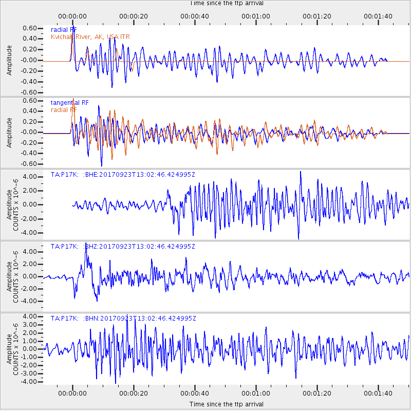
P17K Kvichak River, AK, USA - Earthquake Result Viewer
*The percent match for this event was below the threshold and hence no stack was calculated.
| Earthquake location: |
Oaxaca, Mexico |
| Earthquake latitude/longitude: |
16.7/-94.9 |
| Earthquake time(UTC): |
2017/09/23 (266) 12:53:02 GMT |
| Earthquake Depth: |
9.1 km |
| Earthquake Magnitude: |
6.1 Mww |
| Earthquake Catalog/Contributor: |
NEIC PDE/us |
|
| Network: |
TA USArray Transportable Network (new EarthScope stations) |
| Station: |
P17K Kvichak River, AK, USA |
| Lat/Lon: |
59.20 N/156.44 W |
| Elevation: |
91 m |
|
| Distance: |
61.3 deg |
| Az: |
328.948 deg |
| Baz: |
106.203 deg |
| Ray Param: |
$rayparam |
*The percent match for this event was below the threshold and hence was not used in the summary stack. |
|
| Radial Match: |
77.79552 % |
| Radial Bump: |
400 |
| Transverse Match: |
70.3144 % |
| Transverse Bump: |
400 |
| SOD ConfigId: |
13570011 |
| Insert Time: |
2019-04-28 21:02:31.101 +0000 |
| GWidth: |
2.5 |
| Max Bumps: |
400 |
| Tol: |
0.001 |
|
Signal To Noise
| Channel | StoN | STA | LTA |
| TA:P17K: :BHZ:20170923T13:02:46.424995Z | 10.506136 | 1.9826837E-6 | 1.8871674E-7 |
| TA:P17K: :BHN:20170923T13:02:46.424995Z | 1.5937082 | 7.6859016E-7 | 4.822653E-7 |
| TA:P17K: :BHE:20170923T13:02:46.424995Z | 3.2891188 | 1.3261359E-6 | 4.031888E-7 |
| Arrivals |
| Ps | |
| PpPs | |
| PsPs/PpSs | |


