You are here: Home > Network List > AV - Alaska Volcano Observatory Stations List
> Station AMKA Regional Station, Amchitka Island, Alaska > Earthquake Result Viewer
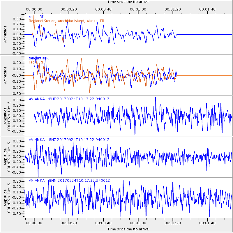
AMKA Regional Station, Amchitka Island, Alaska - Earthquake Result Viewer
*The percent match for this event was below the threshold and hence no stack was calculated.
| Earthquake location: |
Near Coast Of Oaxaca, Mexico |
| Earthquake latitude/longitude: |
15.3/-94.1 |
| Earthquake time(UTC): |
2017/09/24 (267) 10:06:12 GMT |
| Earthquake Depth: |
55 km |
| Earthquake Magnitude: |
5.8 Mww |
| Earthquake Catalog/Contributor: |
NEIC PDE/us |
|
| Network: |
AV Alaska Volcano Observatory |
| Station: |
AMKA Regional Station, Amchitka Island, Alaska |
| Lat/Lon: |
51.38 N/179.30 E |
| Elevation: |
116 m |
|
| Distance: |
76.1 deg |
| Az: |
319.866 deg |
| Baz: |
82.893 deg |
| Ray Param: |
$rayparam |
*The percent match for this event was below the threshold and hence was not used in the summary stack. |
|
| Radial Match: |
64.681206 % |
| Radial Bump: |
400 |
| Transverse Match: |
55.656925 % |
| Transverse Bump: |
400 |
| SOD ConfigId: |
13570011 |
| Insert Time: |
2019-04-28 21:08:22.118 +0000 |
| GWidth: |
2.5 |
| Max Bumps: |
400 |
| Tol: |
0.001 |
|
Signal To Noise
| Channel | StoN | STA | LTA |
| AV:AMKA: :BHZ:20170924T10:17:22.94001Z | 2.719003 | 2.7248495E-7 | 1.00215026E-7 |
| AV:AMKA: :BHN:20170924T10:17:22.94001Z | 1.0138819 | 8.65753E-8 | 8.538993E-8 |
| AV:AMKA: :BHE:20170924T10:17:22.94001Z | 1.1994166 | 9.3332005E-8 | 7.78145E-8 |
| Arrivals |
| Ps | |
| PpPs | |
| PsPs/PpSs | |


