You are here: Home > Network List > TA - USArray Transportable Network (new EarthScope stations) Stations List
> Station F21K Alatna River, AK, USA > Earthquake Result Viewer
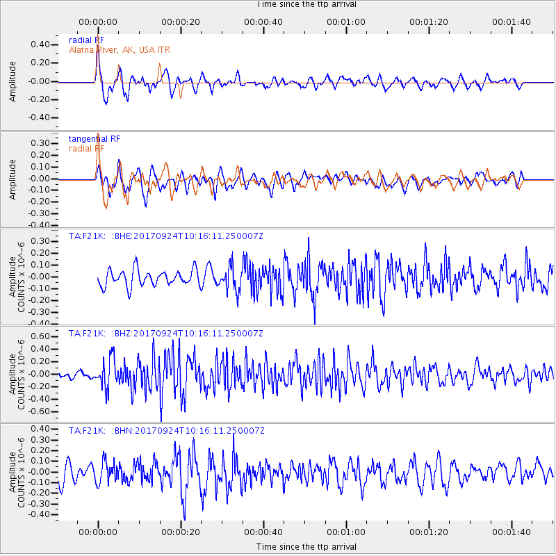
F21K Alatna River, AK, USA - Earthquake Result Viewer
*The percent match for this event was below the threshold and hence no stack was calculated.
| Earthquake location: |
Near Coast Of Oaxaca, Mexico |
| Earthquake latitude/longitude: |
15.3/-94.1 |
| Earthquake time(UTC): |
2017/09/24 (267) 10:06:12 GMT |
| Earthquake Depth: |
55 km |
| Earthquake Magnitude: |
5.8 Mww |
| Earthquake Catalog/Contributor: |
NEIC PDE/us |
|
| Network: |
TA USArray Transportable Network (new EarthScope stations) |
| Station: |
F21K Alatna River, AK, USA |
| Lat/Lon: |
67.22 N/153.48 W |
| Elevation: |
597 m |
|
| Distance: |
64.3 deg |
| Az: |
338.172 deg |
| Baz: |
112.873 deg |
| Ray Param: |
$rayparam |
*The percent match for this event was below the threshold and hence was not used in the summary stack. |
|
| Radial Match: |
68.521645 % |
| Radial Bump: |
400 |
| Transverse Match: |
60.88246 % |
| Transverse Bump: |
400 |
| SOD ConfigId: |
13570011 |
| Insert Time: |
2019-04-28 21:11:46.709 +0000 |
| GWidth: |
2.5 |
| Max Bumps: |
400 |
| Tol: |
0.001 |
|
Signal To Noise
| Channel | StoN | STA | LTA |
| TA:F21K: :BHZ:20170924T10:16:11.250007Z | 3.7037914 | 2.3301371E-7 | 6.2912214E-8 |
| TA:F21K: :BHN:20170924T10:16:11.250007Z | 1.2829603 | 9.557368E-8 | 7.449466E-8 |
| TA:F21K: :BHE:20170924T10:16:11.250007Z | 1.5548499 | 1.0440692E-7 | 6.7149195E-8 |
| Arrivals |
| Ps | |
| PpPs | |
| PsPs/PpSs | |


