You are here: Home > Network List > TA - USArray Transportable Network (new EarthScope stations) Stations List
> Station 223A Chaparral, Anthony, NM, USA > Earthquake Result Viewer
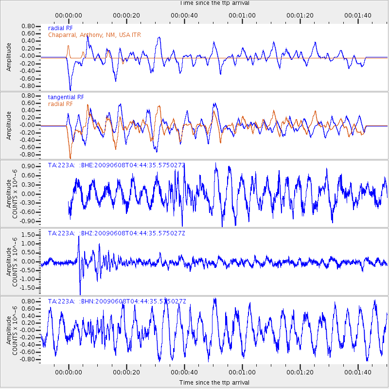
223A Chaparral, Anthony, NM, USA - Earthquake Result Viewer
*The percent match for this event was below the threshold and hence no stack was calculated.
| Earthquake location: |
South Of Fiji Islands |
| Earthquake latitude/longitude: |
-22.2/-179.6 |
| Earthquake time(UTC): |
2009/06/08 (159) 04:33:19 GMT |
| Earthquake Depth: |
612 km |
| Earthquake Magnitude: |
5.5 MW, 5.2 MB |
| Earthquake Catalog/Contributor: |
WHDF/NEIC |
|
| Network: |
TA USArray Transportable Network (new EarthScope stations) |
| Station: |
223A Chaparral, Anthony, NM, USA |
| Lat/Lon: |
32.01 N/106.43 W |
| Elevation: |
1232 m |
|
| Distance: |
88.3 deg |
| Az: |
54.45 deg |
| Baz: |
242.536 deg |
| Ray Param: |
$rayparam |
*The percent match for this event was below the threshold and hence was not used in the summary stack. |
|
| Radial Match: |
60.884445 % |
| Radial Bump: |
400 |
| Transverse Match: |
48.507 % |
| Transverse Bump: |
400 |
| SOD ConfigId: |
2648 |
| Insert Time: |
2010-03-06 04:16:53.399 +0000 |
| GWidth: |
2.5 |
| Max Bumps: |
400 |
| Tol: |
0.001 |
|
Signal To Noise
| Channel | StoN | STA | LTA |
| TA:223A: :BHZ:20090608T04:44:35.575027Z | 4.2686963 | 5.439771E-7 | 1.2743402E-7 |
| TA:223A: :BHN:20090608T04:44:35.575027Z | 0.49050146 | 2.0268547E-7 | 4.132209E-7 |
| TA:223A: :BHE:20090608T04:44:35.575027Z | 1.0763605 | 3.1499988E-7 | 2.9265277E-7 |
| Arrivals |
| Ps | |
| PpPs | |
| PsPs/PpSs | |


