You are here: Home > Network List > TA - USArray Transportable Network (new EarthScope stations) Stations List
> Station 223A Chaparral, Anthony, NM, USA > Earthquake Result Viewer
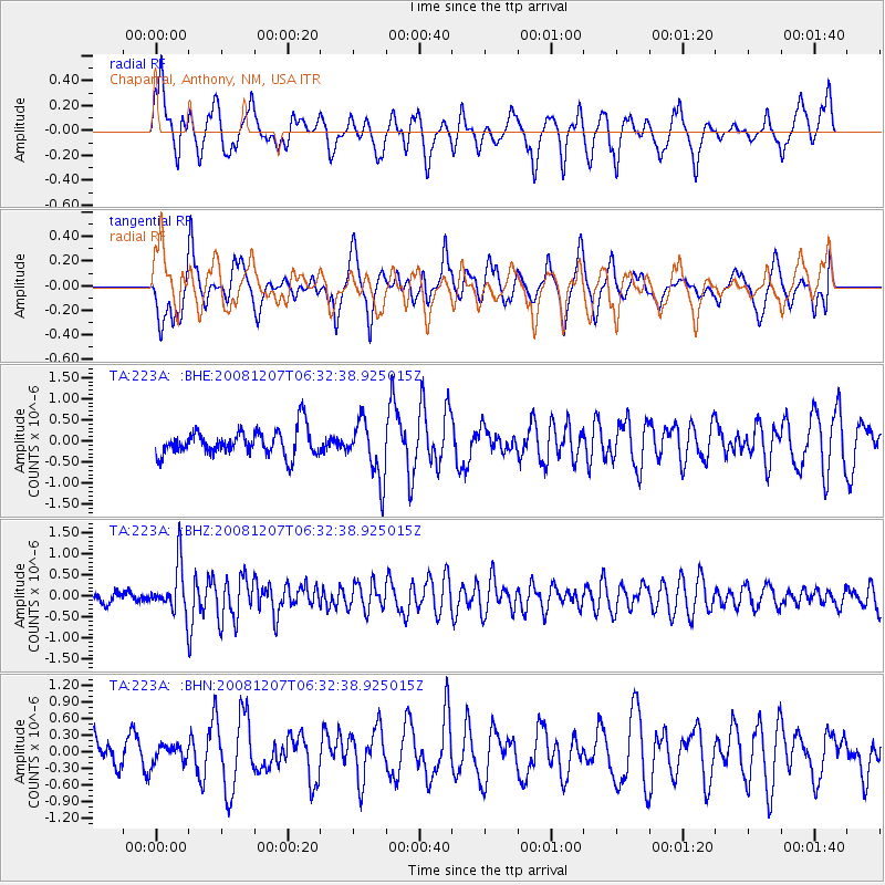
223A Chaparral, Anthony, NM, USA - Earthquake Result Viewer
*The percent match for this event was below the threshold and hence no stack was calculated.
| Earthquake location: |
Northern Mid-Atlantic Ridge |
| Earthquake latitude/longitude: |
13.4/-44.8 |
| Earthquake time(UTC): |
2008/12/07 (342) 06:23:09 GMT |
| Earthquake Depth: |
10 km |
| Earthquake Magnitude: |
5.6 MB, 5.3 MS, 5.7 MW |
| Earthquake Catalog/Contributor: |
WHDF/NEIC |
|
| Network: |
TA USArray Transportable Network (new EarthScope stations) |
| Station: |
223A Chaparral, Anthony, NM, USA |
| Lat/Lon: |
32.01 N/106.43 W |
| Elevation: |
1232 m |
|
| Distance: |
59.0 deg |
| Az: |
299.375 deg |
| Baz: |
93.291 deg |
| Ray Param: |
$rayparam |
*The percent match for this event was below the threshold and hence was not used in the summary stack. |
|
| Radial Match: |
51.862785 % |
| Radial Bump: |
400 |
| Transverse Match: |
64.28507 % |
| Transverse Bump: |
400 |
| SOD ConfigId: |
2658 |
| Insert Time: |
2010-03-06 04:16:55.098 +0000 |
| GWidth: |
2.5 |
| Max Bumps: |
400 |
| Tol: |
0.001 |
|
Signal To Noise
| Channel | StoN | STA | LTA |
| TA:223A: :BHZ:20081207T06:32:38.925015Z | 3.747555 | 5.7803817E-7 | 1.5424406E-7 |
| TA:223A: :BHN:20081207T06:32:38.925015Z | 0.6265673 | 1.6291106E-7 | 2.600057E-7 |
| TA:223A: :BHE:20081207T06:32:38.925015Z | 2.2535975 | 6.8955256E-7 | 3.0597857E-7 |
| Arrivals |
| Ps | |
| PpPs | |
| PsPs/PpSs | |


