You are here: Home > Network List > AV - Alaska Volcano Observatory Stations List
> Station AMKA Regional Station, Amchitka Island, Alaska > Earthquake Result Viewer
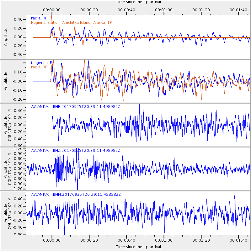
AMKA Regional Station, Amchitka Island, Alaska - Earthquake Result Viewer
*The percent match for this event was below the threshold and hence no stack was calculated.
| Earthquake location: |
New Britain Region, P.N.G. |
| Earthquake latitude/longitude: |
-6.2/152.7 |
| Earthquake time(UTC): |
2017/09/25 (268) 20:29:23 GMT |
| Earthquake Depth: |
6.0 km |
| Earthquake Magnitude: |
5.9 Mww |
| Earthquake Catalog/Contributor: |
NEIC PDE/us |
|
| Network: |
AV Alaska Volcano Observatory |
| Station: |
AMKA Regional Station, Amchitka Island, Alaska |
| Lat/Lon: |
51.38 N/179.30 E |
| Elevation: |
116 m |
|
| Distance: |
61.7 deg |
| Az: |
18.57 deg |
| Baz: |
210.345 deg |
| Ray Param: |
$rayparam |
*The percent match for this event was below the threshold and hence was not used in the summary stack. |
|
| Radial Match: |
57.286514 % |
| Radial Bump: |
400 |
| Transverse Match: |
55.95786 % |
| Transverse Bump: |
400 |
| SOD ConfigId: |
13570011 |
| Insert Time: |
2019-04-28 21:15:12.403 +0000 |
| GWidth: |
2.5 |
| Max Bumps: |
400 |
| Tol: |
0.001 |
|
Signal To Noise
| Channel | StoN | STA | LTA |
| AV:AMKA: :BHZ:20170925T20:39:11.498982Z | 3.6738648 | 5.128528E-7 | 1.395949E-7 |
| AV:AMKA: :BHN:20170925T20:39:11.498982Z | 1.0346754 | 1.4638455E-7 | 1.4147874E-7 |
| AV:AMKA: :BHE:20170925T20:39:11.498982Z | 1.272875 | 1.6008629E-7 | 1.257675E-7 |
| Arrivals |
| Ps | |
| PpPs | |
| PsPs/PpSs | |


