You are here: Home > Network List > AZ - ANZA Regional Network Stations List
> Station LVA2 AZ.LVA2 > Earthquake Result Viewer
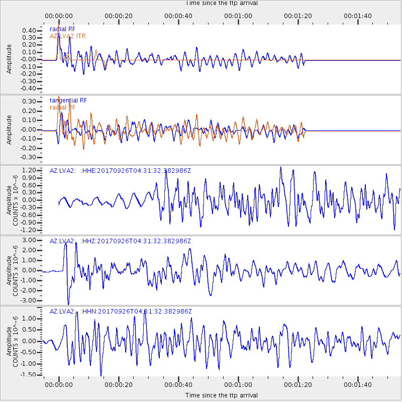
LVA2 AZ.LVA2 - Earthquake Result Viewer
*The percent match for this event was below the threshold and hence no stack was calculated.
| Earthquake location: |
South Of Fiji Islands |
| Earthquake latitude/longitude: |
-23.7/-176.9 |
| Earthquake time(UTC): |
2017/09/26 (269) 04:20:00 GMT |
| Earthquake Depth: |
98 km |
| Earthquake Magnitude: |
6.4 mww |
| Earthquake Catalog/Contributor: |
NEIC PDE/us |
|
| Network: |
AZ ANZA Regional Network |
| Station: |
LVA2 AZ.LVA2 |
| Lat/Lon: |
33.35 N/116.56 W |
| Elevation: |
1435 m |
|
| Distance: |
80.8 deg |
| Az: |
47.488 deg |
| Baz: |
233.823 deg |
| Ray Param: |
$rayparam |
*The percent match for this event was below the threshold and hence was not used in the summary stack. |
|
| Radial Match: |
72.42074 % |
| Radial Bump: |
400 |
| Transverse Match: |
69.593575 % |
| Transverse Bump: |
400 |
| SOD ConfigId: |
13570011 |
| Insert Time: |
2019-04-28 21:25:15.935 +0000 |
| GWidth: |
2.5 |
| Max Bumps: |
400 |
| Tol: |
0.001 |
|
Signal To Noise
| Channel | StoN | STA | LTA |
| AZ:LVA2: :HHZ:20170926T04:31:32.382986Z | 25.889894 | 1.5628974E-6 | 6.036708E-8 |
| AZ:LVA2: :HHN:20170926T04:31:32.382986Z | 5.905943 | 5.1648465E-7 | 8.745168E-8 |
| AZ:LVA2: :HHE:20170926T04:31:32.382986Z | 2.869738 | 3.8768556E-7 | 1.3509441E-7 |
| Arrivals |
| Ps | |
| PpPs | |
| PsPs/PpSs | |


