You are here: Home > Network List > CI - Caltech Regional Seismic Network Stations List
> Station MPP McPhearson Peak > Earthquake Result Viewer
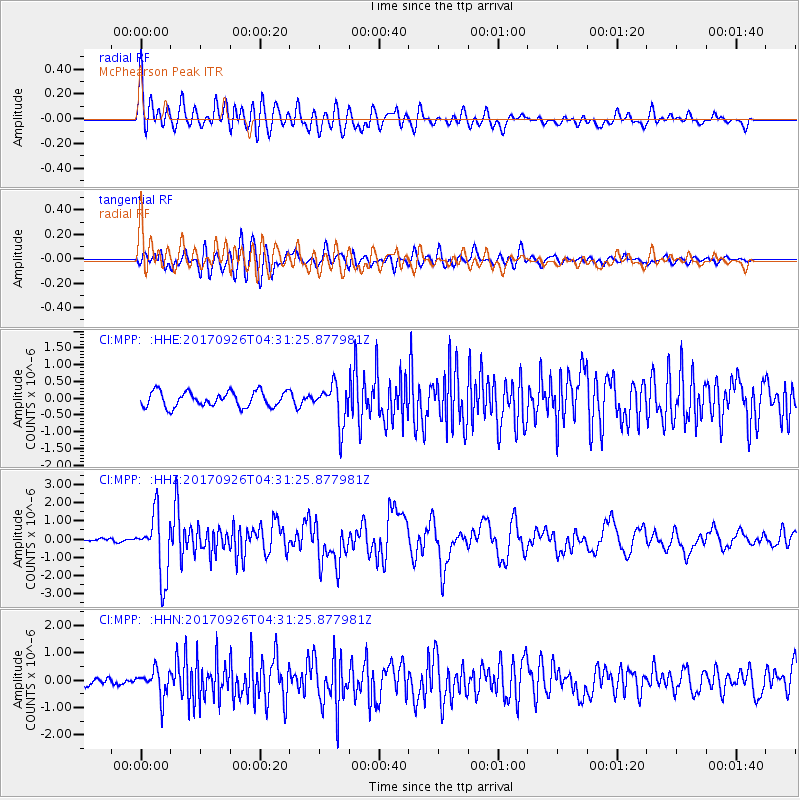
MPP McPhearson Peak - Earthquake Result Viewer
*The percent match for this event was below the threshold and hence no stack was calculated.
| Earthquake location: |
South Of Fiji Islands |
| Earthquake latitude/longitude: |
-23.7/-176.9 |
| Earthquake time(UTC): |
2017/09/26 (269) 04:20:00 GMT |
| Earthquake Depth: |
98 km |
| Earthquake Magnitude: |
6.4 mww |
| Earthquake Catalog/Contributor: |
NEIC PDE/us |
|
| Network: |
CI Caltech Regional Seismic Network |
| Station: |
MPP McPhearson Peak |
| Lat/Lon: |
34.89 N/119.81 W |
| Elevation: |
1739 m |
|
| Distance: |
79.6 deg |
| Az: |
44.59 deg |
| Baz: |
231.511 deg |
| Ray Param: |
$rayparam |
*The percent match for this event was below the threshold and hence was not used in the summary stack. |
|
| Radial Match: |
75.285675 % |
| Radial Bump: |
400 |
| Transverse Match: |
75.396706 % |
| Transverse Bump: |
400 |
| SOD ConfigId: |
13570011 |
| Insert Time: |
2019-04-28 21:26:59.438 +0000 |
| GWidth: |
2.5 |
| Max Bumps: |
400 |
| Tol: |
0.001 |
|
Signal To Noise
| Channel | StoN | STA | LTA |
| CI:MPP: :HHZ:20170926T04:31:25.877981Z | 8.670664 | 1.7191263E-6 | 1.9826929E-7 |
| CI:MPP: :HHN:20170926T04:31:25.877981Z | 3.583372 | 5.0334666E-7 | 1.4046732E-7 |
| CI:MPP: :HHE:20170926T04:31:25.877981Z | 2.594443 | 5.832787E-7 | 2.2481845E-7 |
| Arrivals |
| Ps | |
| PpPs | |
| PsPs/PpSs | |


