You are here: Home > Network List > CI - Caltech Regional Seismic Network Stations List
> Station SMM Simmler, CA, USA > Earthquake Result Viewer
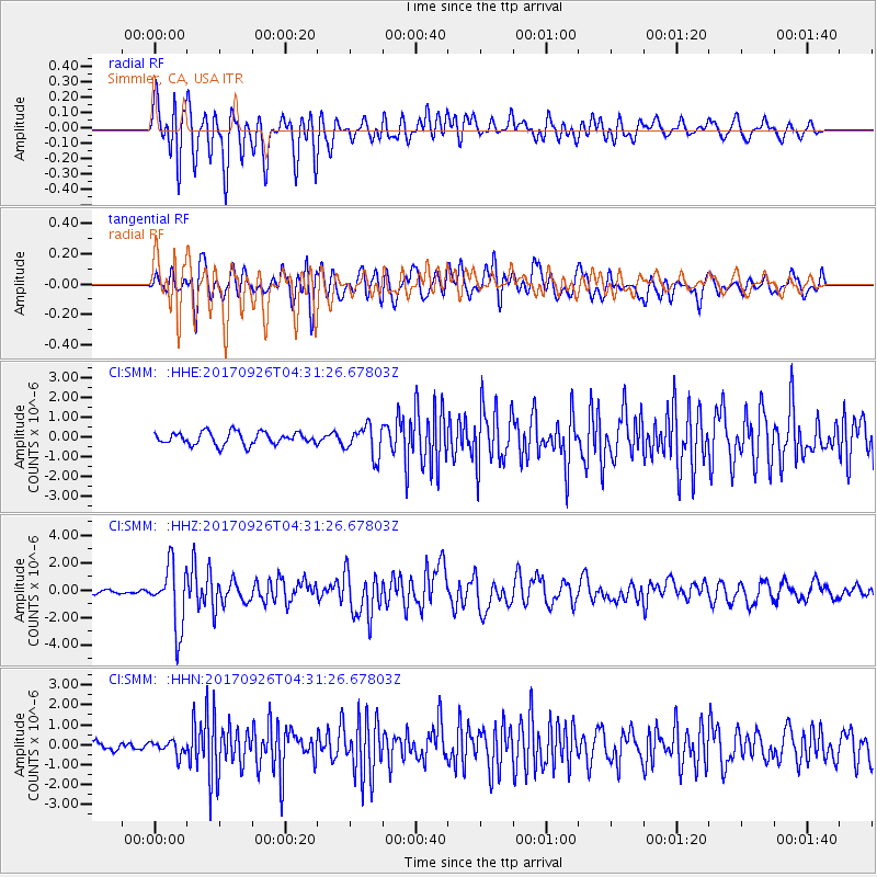
SMM Simmler, CA, USA - Earthquake Result Viewer
*The percent match for this event was below the threshold and hence no stack was calculated.
| Earthquake location: |
South Of Fiji Islands |
| Earthquake latitude/longitude: |
-23.7/-176.9 |
| Earthquake time(UTC): |
2017/09/26 (269) 04:20:00 GMT |
| Earthquake Depth: |
98 km |
| Earthquake Magnitude: |
6.4 mww |
| Earthquake Catalog/Contributor: |
NEIC PDE/us |
|
| Network: |
CI Caltech Regional Seismic Network |
| Station: |
SMM Simmler, CA, USA |
| Lat/Lon: |
35.31 N/120.00 W |
| Elevation: |
599 m |
|
| Distance: |
79.7 deg |
| Az: |
44.158 deg |
| Baz: |
231.329 deg |
| Ray Param: |
$rayparam |
*The percent match for this event was below the threshold and hence was not used in the summary stack. |
|
| Radial Match: |
80.7394 % |
| Radial Bump: |
400 |
| Transverse Match: |
77.66395 % |
| Transverse Bump: |
400 |
| SOD ConfigId: |
13570011 |
| Insert Time: |
2019-04-28 21:27:13.007 +0000 |
| GWidth: |
2.5 |
| Max Bumps: |
400 |
| Tol: |
0.001 |
|
Signal To Noise
| Channel | StoN | STA | LTA |
| CI:SMM: :HHZ:20170926T04:31:26.67803Z | 9.9795265 | 2.2486433E-6 | 2.2532565E-7 |
| CI:SMM: :HHN:20170926T04:31:26.67803Z | 1.5546088 | 3.4641792E-7 | 2.2283284E-7 |
| CI:SMM: :HHE:20170926T04:31:26.67803Z | 2.4416618 | 7.642391E-7 | 3.1299956E-7 |
| Arrivals |
| Ps | |
| PpPs | |
| PsPs/PpSs | |


