You are here: Home > Network List > CN - Canadian National Seismograph Network Stations List
> Station INK INUVIK, NT > Earthquake Result Viewer
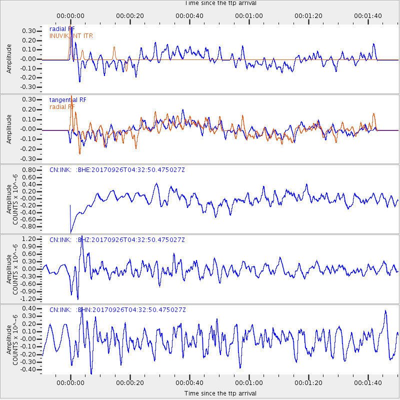
INK INUVIK, NT - Earthquake Result Viewer
*The percent match for this event was below the threshold and hence no stack was calculated.
| Earthquake location: |
South Of Fiji Islands |
| Earthquake latitude/longitude: |
-23.7/-176.9 |
| Earthquake time(UTC): |
2017/09/26 (269) 04:20:00 GMT |
| Earthquake Depth: |
98 km |
| Earthquake Magnitude: |
6.4 mww |
| Earthquake Catalog/Contributor: |
NEIC PDE/us |
|
| Network: |
CN Canadian National Seismograph Network |
| Station: |
INK INUVIK, NT |
| Lat/Lon: |
68.31 N/133.53 W |
| Elevation: |
44 m |
|
| Distance: |
97.1 deg |
| Az: |
14.921 deg |
| Baz: |
219.402 deg |
| Ray Param: |
$rayparam |
*The percent match for this event was below the threshold and hence was not used in the summary stack. |
|
| Radial Match: |
45.01169 % |
| Radial Bump: |
400 |
| Transverse Match: |
29.086401 % |
| Transverse Bump: |
400 |
| SOD ConfigId: |
13570011 |
| Insert Time: |
2019-04-28 21:27:31.879 +0000 |
| GWidth: |
2.5 |
| Max Bumps: |
400 |
| Tol: |
0.001 |
|
Signal To Noise
| Channel | StoN | STA | LTA |
| CN:INK: :BHZ:20170926T04:32:50.475027Z | 7.461204 | 6.564905E-7 | 8.79872E-8 |
| CN:INK: :BHN:20170926T04:32:50.475027Z | 1.6520689 | 2.0292508E-7 | 1.2283088E-7 |
| CN:INK: :BHE:20170926T04:32:50.475027Z | 0.98535156 | 2.6379652E-7 | 2.6771818E-7 |
| Arrivals |
| Ps | |
| PpPs | |
| PsPs/PpSs | |


