You are here: Home > Network List > TA - USArray Transportable Network (new EarthScope stations) Stations List
> Station U25A Circle Dot Ranch, Maxwell, NM, USA > Earthquake Result Viewer
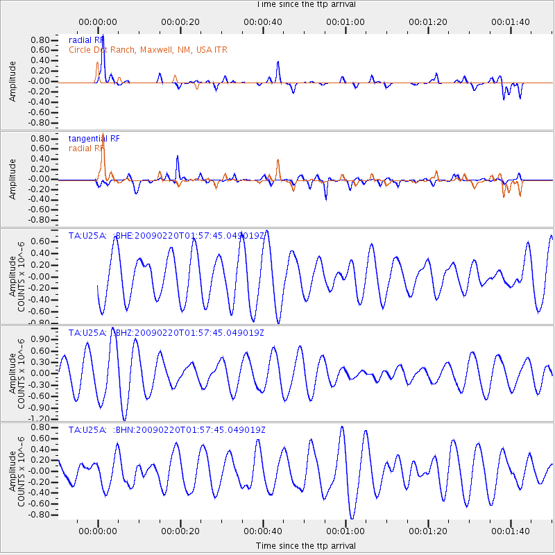
U25A Circle Dot Ranch, Maxwell, NM, USA - Earthquake Result Viewer
*The percent match for this event was below the threshold and hence no stack was calculated.
| Earthquake location: |
Fiji Islands Region |
| Earthquake latitude/longitude: |
-18.4/-178.7 |
| Earthquake time(UTC): |
2009/02/20 (051) 01:46:17 GMT |
| Earthquake Depth: |
515 km |
| Earthquake Magnitude: |
5.6 MW, 5.1 MB, 5.6 MW |
| Earthquake Catalog/Contributor: |
WHDF/NEIC |
|
| Network: |
TA USArray Transportable Network (new EarthScope stations) |
| Station: |
U25A Circle Dot Ranch, Maxwell, NM, USA |
| Lat/Lon: |
36.40 N/104.41 W |
| Elevation: |
1845 m |
|
| Distance: |
88.8 deg |
| Az: |
50.99 deg |
| Baz: |
246.158 deg |
| Ray Param: |
$rayparam |
*The percent match for this event was below the threshold and hence was not used in the summary stack. |
|
| Radial Match: |
83.37071 % |
| Radial Bump: |
315 |
| Transverse Match: |
56.836224 % |
| Transverse Bump: |
312 |
| SOD ConfigId: |
2658 |
| Insert Time: |
2010-03-06 04:20:41.615 +0000 |
| GWidth: |
2.5 |
| Max Bumps: |
400 |
| Tol: |
0.001 |
|
Signal To Noise
| Channel | StoN | STA | LTA |
| TA:U25A: :BHZ:20090220T01:57:45.049019Z | 2.88379 | 7.5634404E-7 | 2.622743E-7 |
| TA:U25A: :BHN:20090220T01:57:45.049019Z | 1.0590483 | 2.8487787E-7 | 2.6899423E-7 |
| TA:U25A: :BHE:20090220T01:57:45.049019Z | 1.0695633 | 4.1436357E-7 | 3.874138E-7 |
| Arrivals |
| Ps | |
| PpPs | |
| PsPs/PpSs | |


