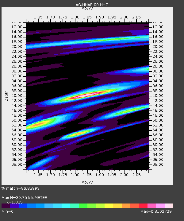
HHAR Hobbs,AR - Earthquake Result Viewer

Earthquake location: Andreanof Islands, Aleutian Is.
Earthquake latitude/longitude: 51.6/-174.0
Earthquake time(UTC): 2016/03/12 (072) 18:06:45 GMT
Earthquake Depth: 19 km
Earthquake Magnitude: 6.3 MWW, 6.1 MB, 6.2 MWB, 6.3 MWC, 6.4 MWC, 6.4 MI
Earthquake Catalog/Contributor: NEIC PDE/NEIC COMCAT
Network: AG Arkansas Seismic Network
Station: HHAR Hobbs,AR
Lat/Lon: 36.28 N/93.94 W
Elevation: 421 m
Distance: 56.8 deg
Az: 71.968 deg
Baz: 312.725 deg
Ray Param: 0.063863486
Estimated Moho Depth: 39.75 km
Estimated Crust Vp/Vs: 1.84
Assumed Crust Vp: 6.53 km/s
Estimated Crust Vs: 3.559 km/s
Estimated Crust Poisson's Ratio: 0.29
Radial Match: 86.85993 %
Radial Bump: 400
Transverse Match: 63.21888 %
Transverse Bump: 400
SOD ConfigId: 1453031
Insert Time: 2016-03-26 18:16:55.173 +0000
GWidth: 2.5
Max Bumps: 400
Tol: 0.001

Signal To Noise

ChannelStoNSTALTA
AG:HHAR:00:HHZ:20160312T18:15:57.550005Z3.08273084.5218766E-71.4668413E-7
AG:HHAR:00:HHN:20160312T18:15:57.550005Z0.87426178.7551825E-81.0014373E-7
AG:HHAR:00:HHE:20160312T18:15:57.550005Z1.76408862.3356068E-71.3239736E-7
Arrivals
Ps5.3 SECOND
PpPs16 SECOND
PsPs/PpSs22 SECOND