You are here: Home > Network List > TA - USArray Transportable Network (new EarthScope stations) Stations List
> Station D25K Kavik River, AK, USA > Earthquake Result Viewer
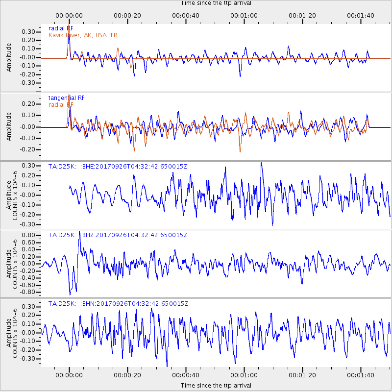
D25K Kavik River, AK, USA - Earthquake Result Viewer
*The percent match for this event was below the threshold and hence no stack was calculated.
| Earthquake location: |
South Of Fiji Islands |
| Earthquake latitude/longitude: |
-23.7/-176.9 |
| Earthquake time(UTC): |
2017/09/26 (269) 04:20:00 GMT |
| Earthquake Depth: |
98 km |
| Earthquake Magnitude: |
6.4 mww |
| Earthquake Catalog/Contributor: |
NEIC PDE/us |
|
| Network: |
TA USArray Transportable Network (new EarthScope stations) |
| Station: |
D25K Kavik River, AK, USA |
| Lat/Lon: |
69.32 N/146.38 W |
| Elevation: |
770 m |
|
| Distance: |
95.4 deg |
| Az: |
10.451 deg |
| Baz: |
207.91 deg |
| Ray Param: |
$rayparam |
*The percent match for this event was below the threshold and hence was not used in the summary stack. |
|
| Radial Match: |
54.781807 % |
| Radial Bump: |
400 |
| Transverse Match: |
61.241226 % |
| Transverse Bump: |
400 |
| SOD ConfigId: |
13570011 |
| Insert Time: |
2019-04-28 21:31:43.624 +0000 |
| GWidth: |
2.5 |
| Max Bumps: |
400 |
| Tol: |
0.001 |
|
Signal To Noise
| Channel | StoN | STA | LTA |
| TA:D25K: :BHZ:20170926T04:32:42.650015Z | 7.5771427 | 5.2203586E-7 | 6.8896135E-8 |
| TA:D25K: :BHN:20170926T04:32:42.650015Z | 1.4747472 | 1.1863314E-7 | 8.044304E-8 |
| TA:D25K: :BHE:20170926T04:32:42.650015Z | 0.87786204 | 7.321343E-8 | 8.33997E-8 |
| Arrivals |
| Ps | |
| PpPs | |
| PsPs/PpSs | |


