You are here: Home > Network List > TA - USArray Transportable Network (new EarthScope stations) Stations List
> Station D23K Nanushuk River, AK USA > Earthquake Result Viewer
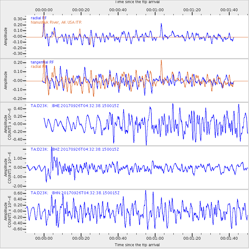
D23K Nanushuk River, AK USA - Earthquake Result Viewer
*The percent match for this event was below the threshold and hence no stack was calculated.
| Earthquake location: |
South Of Fiji Islands |
| Earthquake latitude/longitude: |
-23.7/-176.9 |
| Earthquake time(UTC): |
2017/09/26 (269) 04:20:00 GMT |
| Earthquake Depth: |
98 km |
| Earthquake Magnitude: |
6.4 mww |
| Earthquake Catalog/Contributor: |
NEIC PDE/us |
|
| Network: |
TA USArray Transportable Network (new EarthScope stations) |
| Station: |
D23K Nanushuk River, AK USA |
| Lat/Lon: |
68.97 N/150.68 W |
| Elevation: |
406 m |
|
| Distance: |
94.4 deg |
| Az: |
9.217 deg |
| Baz: |
203.994 deg |
| Ray Param: |
$rayparam |
*The percent match for this event was below the threshold and hence was not used in the summary stack. |
|
| Radial Match: |
61.435448 % |
| Radial Bump: |
400 |
| Transverse Match: |
70.58758 % |
| Transverse Bump: |
400 |
| SOD ConfigId: |
13570011 |
| Insert Time: |
2019-04-28 21:32:41.267 +0000 |
| GWidth: |
2.5 |
| Max Bumps: |
400 |
| Tol: |
0.001 |
|
Signal To Noise
| Channel | StoN | STA | LTA |
| TA:D23K: :BHZ:20170926T04:32:38.150015Z | 5.2865973 | 8.736944E-7 | 1.6526592E-7 |
| TA:D23K: :BHN:20170926T04:32:38.150015Z | 1.6883217 | 2.2304526E-7 | 1.3211064E-7 |
| TA:D23K: :BHE:20170926T04:32:38.150015Z | 1.2991726 | 1.5081764E-7 | 1.16087456E-7 |
| Arrivals |
| Ps | |
| PpPs | |
| PsPs/PpSs | |


