You are here: Home > Network List > TA - USArray Transportable Network (new EarthScope stations) Stations List
> Station J25K Salcha River, AK, USA > Earthquake Result Viewer
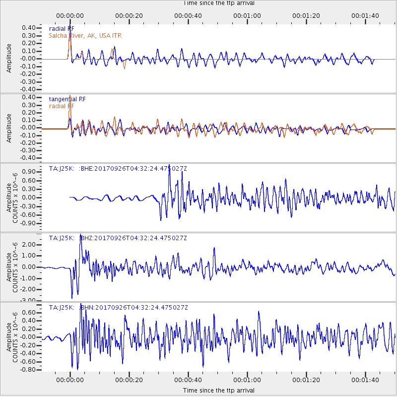
J25K Salcha River, AK, USA - Earthquake Result Viewer
*The percent match for this event was below the threshold and hence no stack was calculated.
| Earthquake location: |
South Of Fiji Islands |
| Earthquake latitude/longitude: |
-23.7/-176.9 |
| Earthquake time(UTC): |
2017/09/26 (269) 04:20:00 GMT |
| Earthquake Depth: |
98 km |
| Earthquake Magnitude: |
6.4 mww |
| Earthquake Catalog/Contributor: |
NEIC PDE/us |
|
| Network: |
TA USArray Transportable Network (new EarthScope stations) |
| Station: |
J25K Salcha River, AK, USA |
| Lat/Lon: |
64.61 N/145.37 W |
| Elevation: |
949 m |
|
| Distance: |
91.4 deg |
| Az: |
13.046 deg |
| Baz: |
208.682 deg |
| Ray Param: |
$rayparam |
*The percent match for this event was below the threshold and hence was not used in the summary stack. |
|
| Radial Match: |
78.70641 % |
| Radial Bump: |
400 |
| Transverse Match: |
75.02342 % |
| Transverse Bump: |
400 |
| SOD ConfigId: |
13570011 |
| Insert Time: |
2019-04-28 21:33:24.326 +0000 |
| GWidth: |
2.5 |
| Max Bumps: |
400 |
| Tol: |
0.001 |
|
Signal To Noise
| Channel | StoN | STA | LTA |
| TA:J25K: :BHZ:20170926T04:32:24.475027Z | 24.716574 | 1.3992905E-6 | 5.6613448E-8 |
| TA:J25K: :BHN:20170926T04:32:24.475027Z | 8.16776 | 3.9290734E-7 | 4.8104663E-8 |
| TA:J25K: :BHE:20170926T04:32:24.475027Z | 7.705081 | 4.1729223E-7 | 5.4158058E-8 |
| Arrivals |
| Ps | |
| PpPs | |
| PsPs/PpSs | |


