U22A Llaves, NM, USA - Earthquake Result Viewer
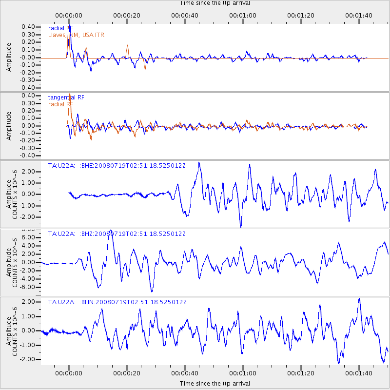
Earthquake location: Off East Coast Of Honshu, Japan
Earthquake latitude/longitude: 37.6/142.2
Earthquake time(UTC): 2008/07/19 (201) 02:39:28 GMT
Earthquake Depth: 22 km
Earthquake Magnitude: 6.2 MB, 7.0 MS, 7.0 MW, 6.9 MW
Earthquake Catalog/Contributor: WHDF/NEIC
Network: TA USArray Transportable Network (new EarthScope stations)
Station: U22A Llaves, NM, USA
Lat/Lon: 36.38 N/106.85 W
Elevation: 2119 m
Distance: 82.6 deg
Az: 49.477 deg
Baz: 311.53 deg
Ray Param: 0.04677131
Estimated Moho Depth: 15.25 km
Estimated Crust Vp/Vs: 1.60
Assumed Crust Vp: 6.159 km/s
Estimated Crust Vs: 3.849 km/s
Estimated Crust Poisson's Ratio: 0.18
Radial Match: 93.48948 %
Radial Bump: 400
Transverse Match: 88.14287 %
Transverse Bump: 400
SOD ConfigId: 2504
Insert Time: 2010-03-06 04:22:01.951 +0000
GWidth: 2.5
Max Bumps: 400
Tol: 0.001

Signal To Noise

ChannelStoNSTALTA
TA:U22A: :BHZ:20080719T02:51:18.525012Z3.86204935.127298E-71.3276107E-7
TA:U22A: :BHN:20080719T02:51:18.525012Z1.05479241.1745931E-71.1135776E-7
TA:U22A: :BHE:20080719T02:51:18.525012Z1.34634751.4026025E-71.0417835E-7
Arrivals
Ps1.5 SECOND
PpPs6.3 SECOND
PsPs/PpSs7.8 SECOND