You are here: Home > Network List > TA - USArray Transportable Network (new EarthScope stations) Stations List
> Station V35K Ketchikan, AK, USA > Earthquake Result Viewer
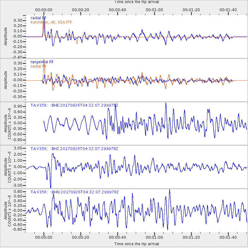
V35K Ketchikan, AK, USA - Earthquake Result Viewer
*The percent match for this event was below the threshold and hence no stack was calculated.
| Earthquake location: |
South Of Fiji Islands |
| Earthquake latitude/longitude: |
-23.7/-176.9 |
| Earthquake time(UTC): |
2017/09/26 (269) 04:20:00 GMT |
| Earthquake Depth: |
98 km |
| Earthquake Magnitude: |
6.4 mww |
| Earthquake Catalog/Contributor: |
NEIC PDE/us |
|
| Network: |
TA USArray Transportable Network (new EarthScope stations) |
| Station: |
V35K Ketchikan, AK, USA |
| Lat/Lon: |
55.33 N/131.62 W |
| Elevation: |
64 m |
|
| Distance: |
87.7 deg |
| Az: |
23.996 deg |
| Baz: |
220.712 deg |
| Ray Param: |
$rayparam |
*The percent match for this event was below the threshold and hence was not used in the summary stack. |
|
| Radial Match: |
78.06873 % |
| Radial Bump: |
336 |
| Transverse Match: |
59.902863 % |
| Transverse Bump: |
400 |
| SOD ConfigId: |
13570011 |
| Insert Time: |
2019-04-28 21:34:38.614 +0000 |
| GWidth: |
2.5 |
| Max Bumps: |
400 |
| Tol: |
0.001 |
|
Signal To Noise
| Channel | StoN | STA | LTA |
| TA:V35K: :BHZ:20170926T04:32:07.299978Z | 7.637616 | 1.2811661E-6 | 1.6774425E-7 |
| TA:V35K: :BHN:20170926T04:32:07.299978Z | 2.4874573 | 3.511306E-7 | 1.4116046E-7 |
| TA:V35K: :BHE:20170926T04:32:07.299978Z | 1.3955733 | 3.545607E-7 | 2.5406098E-7 |
| Arrivals |
| Ps | |
| PpPs | |
| PsPs/PpSs | |


