OK039 N2440 and E0440 Rds, Cleo Springs, OK, USA - Earthquake Result Viewer
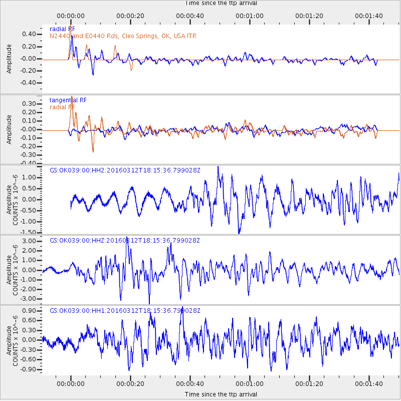
Earthquake location: Andreanof Islands, Aleutian Is.
Earthquake latitude/longitude: 51.6/-174.0
Earthquake time(UTC): 2016/03/12 (072) 18:06:45 GMT
Earthquake Depth: 19 km
Earthquake Magnitude: 6.3 MWW, 6.1 MB, 6.2 MWB, 6.3 MWC, 6.4 MWC, 6.4 MI
Earthquake Catalog/Contributor: NEIC PDE/NEIC COMCAT
Network: GS US Geological Survey Networks
Station: OK039 N2440 and E0440 Rds, Cleo Springs, OK, USA
Lat/Lon: 36.38 N/98.65 W
Elevation: 400 m
Distance: 53.9 deg
Az: 74.982 deg
Baz: 311.658 deg
Ray Param: 0.065738045
Estimated Moho Depth: 15.75 km
Estimated Crust Vp/Vs: 1.62
Assumed Crust Vp: 6.426 km/s
Estimated Crust Vs: 3.979 km/s
Estimated Crust Poisson's Ratio: 0.19
Radial Match: 81.6942 %
Radial Bump: 307
Transverse Match: 63.047012 %
Transverse Bump: 400
SOD ConfigId: 1453031
Insert Time: 2016-03-26 18:26:34.501 +0000
GWidth: 2.5
Max Bumps: 400
Tol: 0.001

Signal To Noise

ChannelStoNSTALTA
GS:OK039:00:HHZ:20160312T18:15:36.799028Z2.4955234.5368975E-71.8180147E-7
GS:OK039:00:HH1:20160312T18:15:36.799028Z1.35398851.6356844E-71.208049E-7
GS:OK039:00:HH2:20160312T18:15:36.799028Z1.22107373.485327E-72.8543133E-7
Arrivals
Ps1.6 SECOND
PpPs6.0 SECOND
PsPs/PpSs7.6 SECOND