U22A Llaves, NM, USA - Earthquake Result Viewer
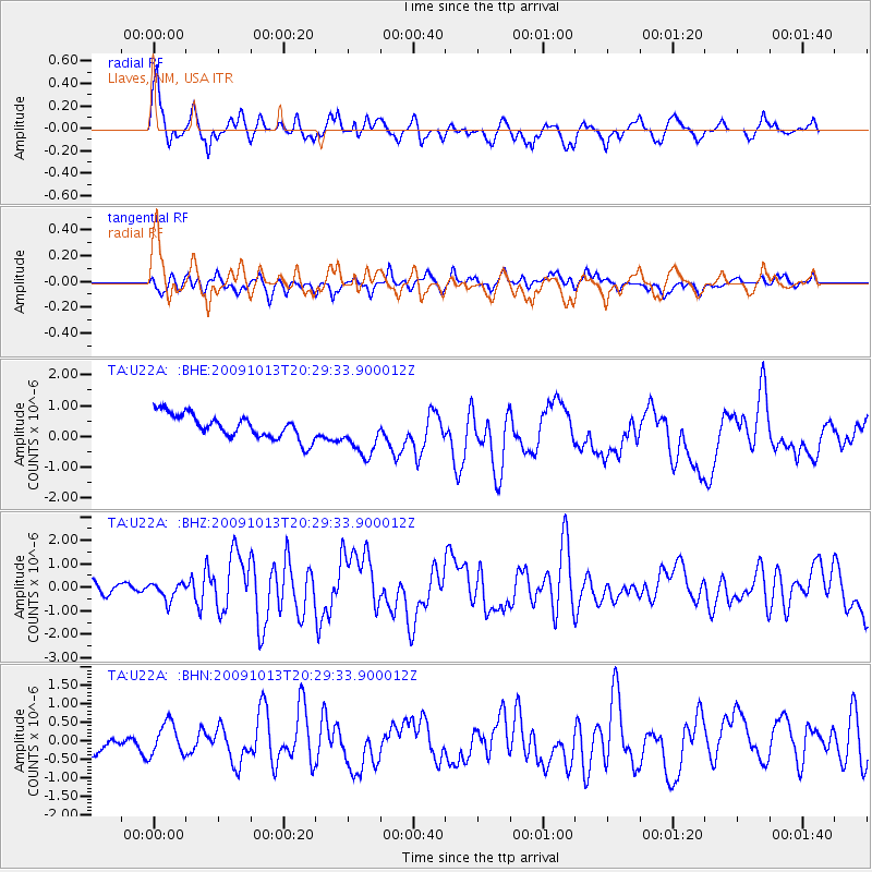
Earthquake location: Fox Islands, Aleutian Islands
Earthquake latitude/longitude: 52.6/-167.1
Earthquake time(UTC): 2009/10/13 (286) 20:21:53 GMT
Earthquake Depth: 14 km
Earthquake Magnitude: 5.9 MB, 6.4 MS, 6.4 MW, 6.4 MW
Earthquake Catalog/Contributor: WHDF/NEIC
Network: TA USArray Transportable Network (new EarthScope stations)
Station: U22A Llaves, NM, USA
Lat/Lon: 36.38 N/106.85 W
Elevation: 2119 m
Distance: 44.6 deg
Az: 86.495 deg
Baz: 311.034 deg
Ray Param: 0.071811
Estimated Moho Depth: 45.75 km
Estimated Crust Vp/Vs: 1.79
Assumed Crust Vp: 6.159 km/s
Estimated Crust Vs: 3.436 km/s
Estimated Crust Poisson's Ratio: 0.27
Radial Match: 81.57044 %
Radial Bump: 400
Transverse Match: 64.858345 %
Transverse Bump: 400
SOD ConfigId: 2622
Insert Time: 2010-03-06 04:24:27.068 +0000
GWidth: 2.5
Max Bumps: 400
Tol: 0.001

Signal To Noise

ChannelStoNSTALTA
TA:U22A: :BHZ:20091013T20:29:33.900012Z1.94017183.7335008E-71.9243144E-7
TA:U22A: :BHN:20091013T20:29:33.900012Z1.23676114.4705317E-73.6147094E-7
TA:U22A: :BHE:20091013T20:29:33.900012Z1.83228127.18703E-73.922449E-7
Arrivals
Ps6.2 SECOND
PpPs20 SECOND
PsPs/PpSs26 SECOND