You are here: Home > Network List > TA - USArray Transportable Network (new EarthScope stations) Stations List
> Station U22A Llaves, NM, USA > Earthquake Result Viewer
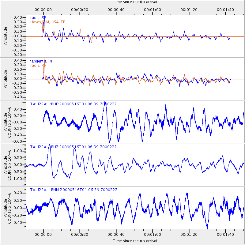
U22A Llaves, NM, USA - Earthquake Result Viewer
*The percent match for this event was below the threshold and hence no stack was calculated.
| Earthquake location: |
Kermadec Islands Region |
| Earthquake latitude/longitude: |
-31.5/-178.8 |
| Earthquake time(UTC): |
2009/05/16 (136) 00:53:52 GMT |
| Earthquake Depth: |
55 km |
| Earthquake Magnitude: |
6.1 MB, 6.5 MW, 6.3 MW |
| Earthquake Catalog/Contributor: |
WHDF/NEIC |
|
| Network: |
TA USArray Transportable Network (new EarthScope stations) |
| Station: |
U22A Llaves, NM, USA |
| Lat/Lon: |
36.38 N/106.85 W |
| Elevation: |
2119 m |
|
| Distance: |
95.4 deg |
| Az: |
50.411 deg |
| Baz: |
234.638 deg |
| Ray Param: |
$rayparam |
*The percent match for this event was below the threshold and hence was not used in the summary stack. |
|
| Radial Match: |
75.67389 % |
| Radial Bump: |
400 |
| Transverse Match: |
64.68012 % |
| Transverse Bump: |
400 |
| SOD ConfigId: |
2760 |
| Insert Time: |
2010-03-06 04:24:54.220 +0000 |
| GWidth: |
2.5 |
| Max Bumps: |
400 |
| Tol: |
0.001 |
|
Signal To Noise
| Channel | StoN | STA | LTA |
| TA:U22A: :BHZ:20090516T01:06:39.700022Z | 5.9746885 | 7.1068393E-7 | 1.18949124E-7 |
| TA:U22A: :BHN:20090516T01:06:39.700022Z | 2.160804 | 1.6921516E-7 | 7.8311196E-8 |
| TA:U22A: :BHE:20090516T01:06:39.700022Z | 2.2894144 | 3.0460563E-7 | 1.330496E-7 |
| Arrivals |
| Ps | |
| PpPs | |
| PsPs/PpSs | |


