You are here: Home > Network List > TA - USArray Transportable Network (new EarthScope stations) Stations List
> Station U22A Llaves, NM, USA > Earthquake Result Viewer
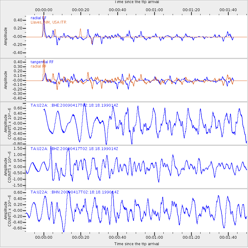
U22A Llaves, NM, USA - Earthquake Result Viewer
*The percent match for this event was below the threshold and hence no stack was calculated.
| Earthquake location: |
Near Coast Of Northern Chile |
| Earthquake latitude/longitude: |
-19.6/-70.5 |
| Earthquake time(UTC): |
2009/04/17 (107) 02:08:08 GMT |
| Earthquake Depth: |
25 km |
| Earthquake Magnitude: |
5.8 MB, 5.8 MS, 6.1 MW, 6.1 MW |
| Earthquake Catalog/Contributor: |
WHDF/NEIC |
|
| Network: |
TA USArray Transportable Network (new EarthScope stations) |
| Station: |
U22A Llaves, NM, USA |
| Lat/Lon: |
36.38 N/106.85 W |
| Elevation: |
2119 m |
|
| Distance: |
65.4 deg |
| Az: |
328.247 deg |
| Baz: |
142.06 deg |
| Ray Param: |
$rayparam |
*The percent match for this event was below the threshold and hence was not used in the summary stack. |
|
| Radial Match: |
72.341835 % |
| Radial Bump: |
343 |
| Transverse Match: |
53.494484 % |
| Transverse Bump: |
380 |
| SOD ConfigId: |
2658 |
| Insert Time: |
2010-03-06 04:25:19.905 +0000 |
| GWidth: |
2.5 |
| Max Bumps: |
400 |
| Tol: |
0.001 |
|
Signal To Noise
| Channel | StoN | STA | LTA |
| TA:U22A: :BHZ:20090417T02:18:18.199014Z | 2.8711329 | 6.3389484E-7 | 2.2078213E-7 |
| TA:U22A: :BHN:20090417T02:18:18.199014Z | 2.0881135 | 2.8897082E-7 | 1.3838846E-7 |
| TA:U22A: :BHE:20090417T02:18:18.199014Z | 0.96586555 | 3.4366306E-7 | 3.558084E-7 |
| Arrivals |
| Ps | |
| PpPs | |
| PsPs/PpSs | |


