You are here: Home > Network List > CI - Caltech Regional Seismic Network Stations List
> Station MPP McPhearson Peak > Earthquake Result Viewer
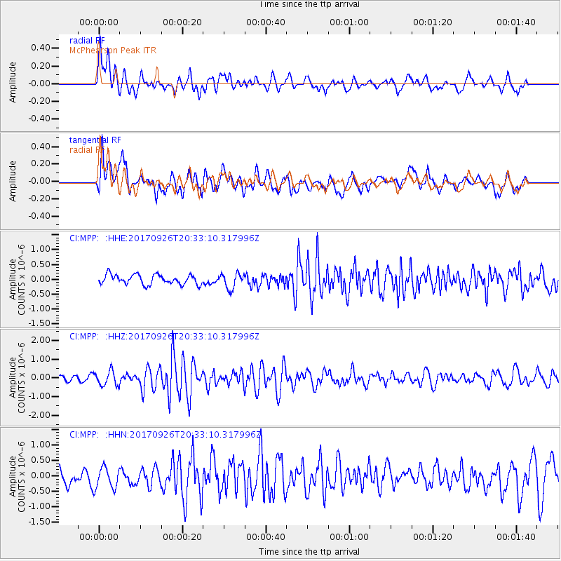
MPP McPhearson Peak - Earthquake Result Viewer
*The percent match for this event was below the threshold and hence no stack was calculated.
| Earthquake location: |
Near East Coast Of Honshu, Japan |
| Earthquake latitude/longitude: |
40.3/142.4 |
| Earthquake time(UTC): |
2017/09/26 (269) 20:22:11 GMT |
| Earthquake Depth: |
36 km |
| Earthquake Magnitude: |
5.8 Mww |
| Earthquake Catalog/Contributor: |
NEIC PDE/us |
|
| Network: |
CI Caltech Regional Seismic Network |
| Station: |
MPP McPhearson Peak |
| Lat/Lon: |
34.89 N/119.81 W |
| Elevation: |
1739 m |
|
| Distance: |
73.6 deg |
| Az: |
58.095 deg |
| Baz: |
307.856 deg |
| Ray Param: |
$rayparam |
*The percent match for this event was below the threshold and hence was not used in the summary stack. |
|
| Radial Match: |
66.56699 % |
| Radial Bump: |
400 |
| Transverse Match: |
64.17429 % |
| Transverse Bump: |
400 |
| SOD ConfigId: |
13570011 |
| Insert Time: |
2019-04-28 21:39:47.787 +0000 |
| GWidth: |
2.5 |
| Max Bumps: |
400 |
| Tol: |
0.001 |
|
Signal To Noise
| Channel | StoN | STA | LTA |
| CI:MPP: :HHZ:20170926T20:33:10.317996Z | 2.1974497 | 3.8885818E-7 | 1.7695885E-7 |
| CI:MPP: :HHN:20170926T20:33:10.317996Z | 1.1902 | 3.5327656E-7 | 2.9682118E-7 |
| CI:MPP: :HHE:20170926T20:33:10.317996Z | 1.6371261 | 2.6527104E-7 | 1.6203458E-7 |
| Arrivals |
| Ps | |
| PpPs | |
| PsPs/PpSs | |


