You are here: Home > Network List > TA - USArray Transportable Network (new EarthScope stations) Stations List
> Station U22A Llaves, NM, USA > Earthquake Result Viewer
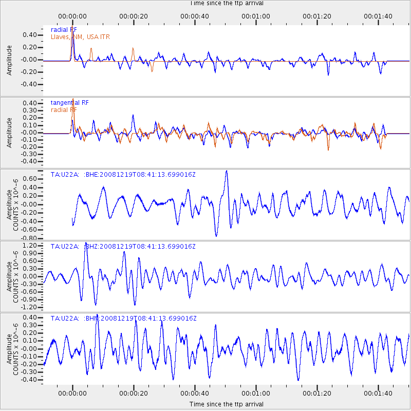
U22A Llaves, NM, USA - Earthquake Result Viewer
*The percent match for this event was below the threshold and hence no stack was calculated.
| Earthquake location: |
Northern Mid-Atlantic Ridge |
| Earthquake latitude/longitude: |
47.0/-27.3 |
| Earthquake time(UTC): |
2008/12/19 (354) 08:31:51 GMT |
| Earthquake Depth: |
2.0 km |
| Earthquake Magnitude: |
5.8 MB, 5.6 MS, 5.9 MW, 5.8 MW |
| Earthquake Catalog/Contributor: |
WHDF/NEIC |
|
| Network: |
TA USArray Transportable Network (new EarthScope stations) |
| Station: |
U22A Llaves, NM, USA |
| Lat/Lon: |
36.38 N/106.85 W |
| Elevation: |
2119 m |
|
| Distance: |
58.0 deg |
| Az: |
290.555 deg |
| Baz: |
52.571 deg |
| Ray Param: |
$rayparam |
*The percent match for this event was below the threshold and hence was not used in the summary stack. |
|
| Radial Match: |
68.243744 % |
| Radial Bump: |
366 |
| Transverse Match: |
73.83942 % |
| Transverse Bump: |
400 |
| SOD ConfigId: |
2658 |
| Insert Time: |
2010-03-06 04:26:20.305 +0000 |
| GWidth: |
2.5 |
| Max Bumps: |
400 |
| Tol: |
0.001 |
|
Signal To Noise
| Channel | StoN | STA | LTA |
| TA:U22A: :BHZ:20081219T08:41:13.699016Z | 5.1187925 | 6.0992807E-7 | 1.1915468E-7 |
| TA:U22A: :BHN:20081219T08:41:13.699016Z | 0.7226239 | 1.1552964E-7 | 1.598752E-7 |
| TA:U22A: :BHE:20081219T08:41:13.699016Z | 0.9351775 | 1.8757788E-7 | 2.0057999E-7 |
| Arrivals |
| Ps | |
| PpPs | |
| PsPs/PpSs | |


