You are here: Home > Network List > TA - USArray Transportable Network (new EarthScope stations) Stations List
> Station J26L Joseph Creek, AK, USA > Earthquake Result Viewer
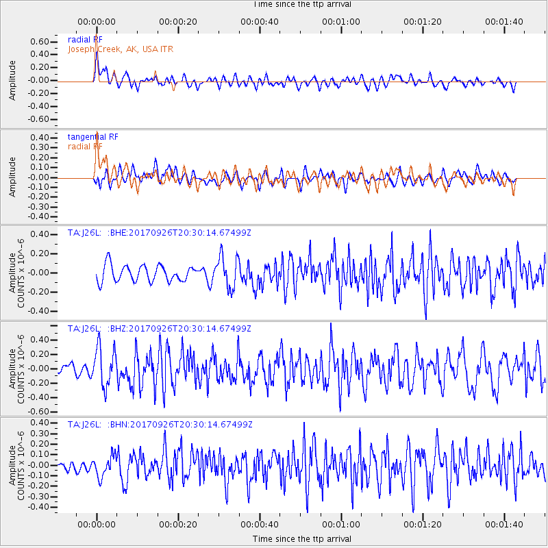
J26L Joseph Creek, AK, USA - Earthquake Result Viewer
*The percent match for this event was below the threshold and hence no stack was calculated.
| Earthquake location: |
Near East Coast Of Honshu, Japan |
| Earthquake latitude/longitude: |
40.3/142.4 |
| Earthquake time(UTC): |
2017/09/26 (269) 20:22:11 GMT |
| Earthquake Depth: |
36 km |
| Earthquake Magnitude: |
5.8 Mww |
| Earthquake Catalog/Contributor: |
NEIC PDE/us |
|
| Network: |
TA USArray Transportable Network (new EarthScope stations) |
| Station: |
J26L Joseph Creek, AK, USA |
| Lat/Lon: |
64.50 N/143.56 W |
| Elevation: |
1144 m |
|
| Distance: |
47.8 deg |
| Az: |
34.194 deg |
| Baz: |
276.931 deg |
| Ray Param: |
$rayparam |
*The percent match for this event was below the threshold and hence was not used in the summary stack. |
|
| Radial Match: |
66.29768 % |
| Radial Bump: |
400 |
| Transverse Match: |
56.540657 % |
| Transverse Bump: |
400 |
| SOD ConfigId: |
13570011 |
| Insert Time: |
2019-04-28 21:46:45.345 +0000 |
| GWidth: |
2.5 |
| Max Bumps: |
400 |
| Tol: |
0.001 |
|
Signal To Noise
| Channel | StoN | STA | LTA |
| TA:J26L: :BHZ:20170926T20:30:14.67499Z | 2.9557593 | 2.755514E-7 | 9.3225246E-8 |
| TA:J26L: :BHN:20170926T20:30:14.67499Z | 1.4141735 | 1.0051225E-7 | 7.107491E-8 |
| TA:J26L: :BHE:20170926T20:30:14.67499Z | 1.9823242 | 1.6749951E-7 | 8.449653E-8 |
| Arrivals |
| Ps | |
| PpPs | |
| PsPs/PpSs | |


