You are here: Home > Network List > TA - USArray Transportable Network (new EarthScope stations) Stations List
> Station TPFO Pinon Flats, CA, USA > Earthquake Result Viewer
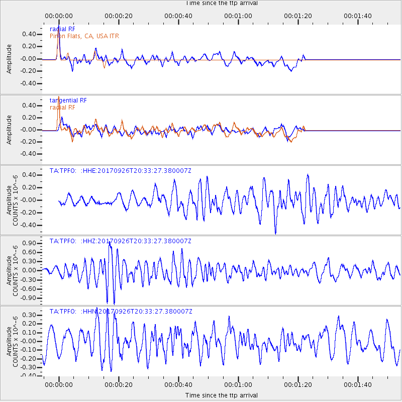
TPFO Pinon Flats, CA, USA - Earthquake Result Viewer
*The percent match for this event was below the threshold and hence no stack was calculated.
| Earthquake location: |
Near East Coast Of Honshu, Japan |
| Earthquake latitude/longitude: |
40.3/142.4 |
| Earthquake time(UTC): |
2017/09/26 (269) 20:22:11 GMT |
| Earthquake Depth: |
36 km |
| Earthquake Magnitude: |
5.8 Mww |
| Earthquake Catalog/Contributor: |
NEIC PDE/us |
|
| Network: |
TA USArray Transportable Network (new EarthScope stations) |
| Station: |
TPFO Pinon Flats, CA, USA |
| Lat/Lon: |
33.61 N/116.45 W |
| Elevation: |
1275 m |
|
| Distance: |
76.6 deg |
| Az: |
57.328 deg |
| Baz: |
309.541 deg |
| Ray Param: |
$rayparam |
*The percent match for this event was below the threshold and hence was not used in the summary stack. |
|
| Radial Match: |
74.886894 % |
| Radial Bump: |
400 |
| Transverse Match: |
57.313683 % |
| Transverse Bump: |
400 |
| SOD ConfigId: |
13570011 |
| Insert Time: |
2019-04-28 21:47:43.761 +0000 |
| GWidth: |
2.5 |
| Max Bumps: |
400 |
| Tol: |
0.001 |
|
Signal To Noise
| Channel | StoN | STA | LTA |
| TA:TPFO: :HHZ:20170926T20:33:27.380007Z | 1.8344654 | 1.4944808E-7 | 8.146684E-8 |
| TA:TPFO: :HHN:20170926T20:33:27.380007Z | 1.9548029 | 1.15440734E-7 | 5.9054923E-8 |
| TA:TPFO: :HHE:20170926T20:33:27.380007Z | 1.7908423 | 1.1604198E-7 | 6.479743E-8 |
| Arrivals |
| Ps | |
| PpPs | |
| PsPs/PpSs | |


