
EGMT Eagleton, Montana, USA - Earthquake Result Viewer
| ||||||||||||||||||
| ||||||||||||||||||
| ||||||||||||||||||
|
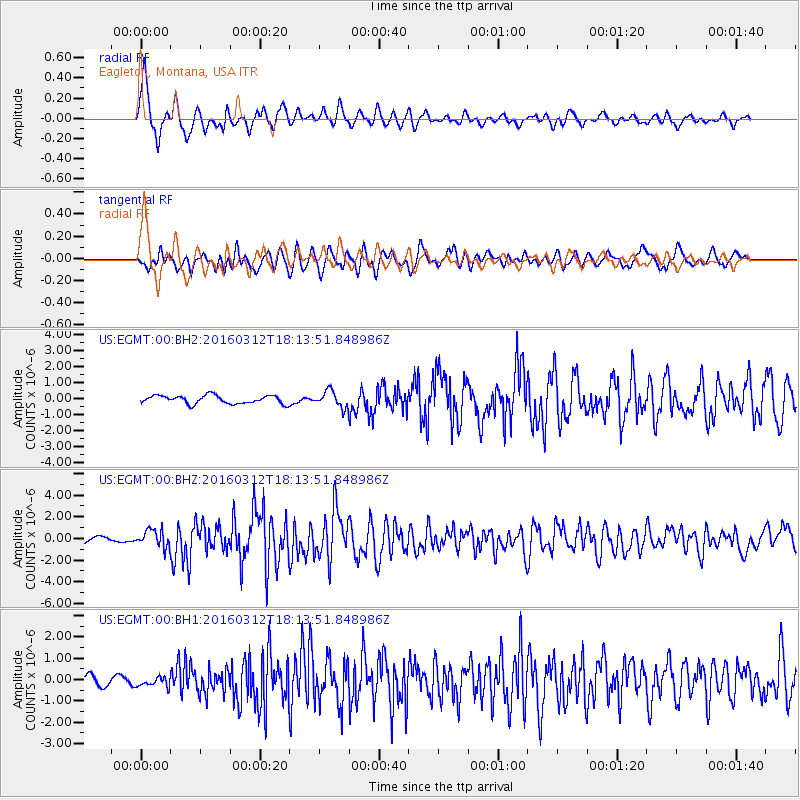
Signal To Noise
| Channel | StoN | STA | LTA |
| US:EGMT:00:BHZ:20160312T18:13:51.848986Z | 3.269882 | 8.0867045E-7 | 2.4730875E-7 |
| US:EGMT:00:BH1:20160312T18:13:51.848986Z | 0.67178255 | 2.0716332E-7 | 3.0837856E-7 |
| US:EGMT:00:BH2:20160312T18:13:51.848986Z | 2.0058694 | 5.0455304E-7 | 2.5153835E-7 |
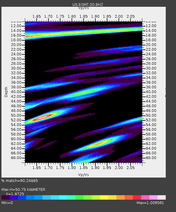
| Arrivals | |
| Ps | 5.7 SECOND |
| PpPs | 20 SECOND |
| PsPs/PpSs | 25 SECOND |

