TZTN Tazewell, Tennessee, USA - Earthquake Result Viewer
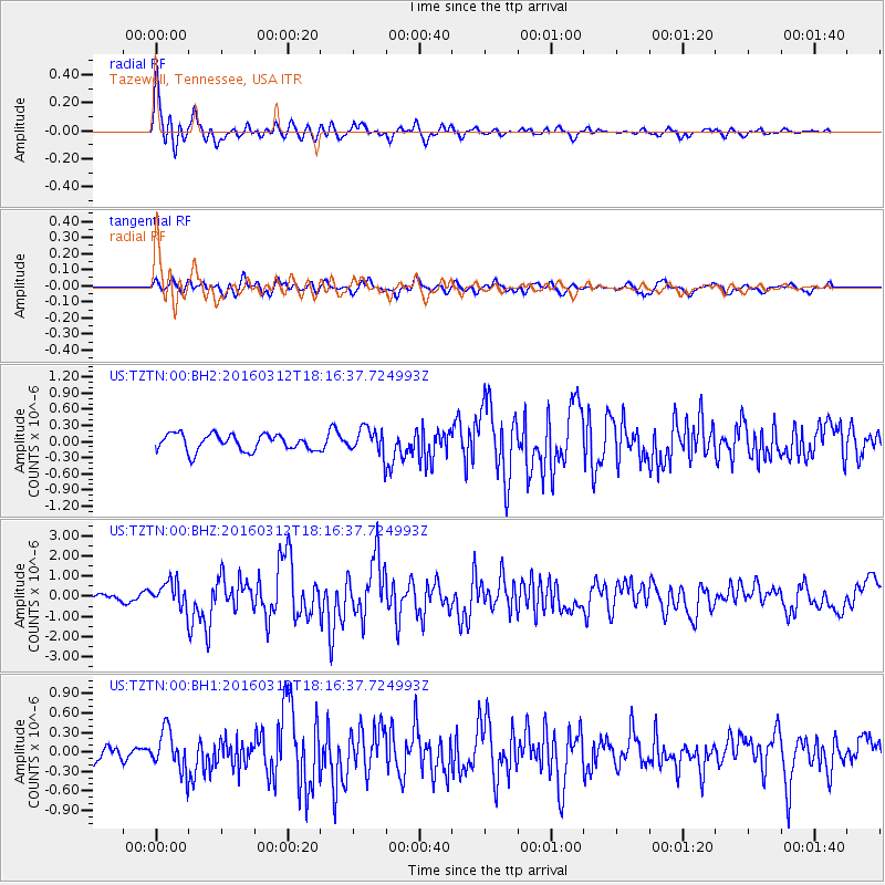
Earthquake location: Andreanof Islands, Aleutian Is.
Earthquake latitude/longitude: 51.6/-174.0
Earthquake time(UTC): 2016/03/12 (072) 18:06:45 GMT
Earthquake Depth: 19 km
Earthquake Magnitude: 6.3 MWW, 6.1 MB, 6.2 MWB, 6.3 MWC, 6.4 MWC, 6.4 MI
Earthquake Catalog/Contributor: NEIC PDE/NEIC COMCAT
Network: US United States National Seismic Network
Station: TZTN Tazewell, Tennessee, USA
Lat/Lon: 36.54 N/83.55 W
Elevation: 394 m
Distance: 62.7 deg
Az: 65.01 deg
Baz: 315.365 deg
Ray Param: 0.060048595
Estimated Moho Depth: 43.75 km
Estimated Crust Vp/Vs: 1.83
Assumed Crust Vp: 6.476 km/s
Estimated Crust Vs: 3.539 km/s
Estimated Crust Poisson's Ratio: 0.29
Radial Match: 88.52816 %
Radial Bump: 400
Transverse Match: 71.96783 %
Transverse Bump: 400
SOD ConfigId: 1453031
Insert Time: 2016-03-26 18:39:50.249 +0000
GWidth: 2.5
Max Bumps: 400
Tol: 0.001

Signal To Noise

ChannelStoNSTALTA
US:TZTN:00:BHZ:20160312T18:16:37.724993Z3.14294986.3736115E-72.0279076E-7
US:TZTN:00:BH1:20160312T18:16:37.724993Z2.311363.113847E-71.3471926E-7
US:TZTN:00:BH2:20160312T18:16:37.724993Z1.59955682.4346485E-71.522077E-7
Arrivals
Ps5.9 SECOND
PpPs18 SECOND
PsPs/PpSs24 SECOND