You are here: Home > Network List > TA - USArray Transportable Network (new EarthScope stations) Stations List
> Station F20K Avaraart Lake, AK, USA > Earthquake Result Viewer
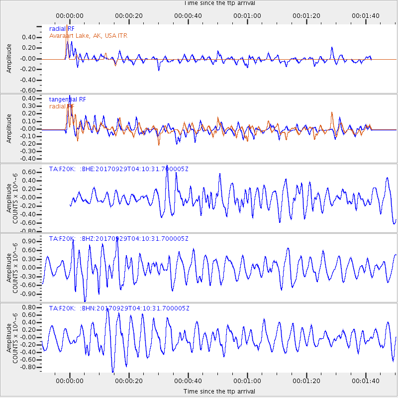
F20K Avaraart Lake, AK, USA - Earthquake Result Viewer
*The percent match for this event was below the threshold and hence no stack was calculated.
| Earthquake location: |
Off Coast Of Chiapas, Mexico |
| Earthquake latitude/longitude: |
14.9/-94.0 |
| Earthquake time(UTC): |
2017/09/29 (272) 04:00:22 GMT |
| Earthquake Depth: |
22 km |
| Earthquake Magnitude: |
5.6 mb |
| Earthquake Catalog/Contributor: |
NEIC PDE/us |
|
| Network: |
TA USArray Transportable Network (new EarthScope stations) |
| Station: |
F20K Avaraart Lake, AK, USA |
| Lat/Lon: |
67.05 N/155.73 W |
| Elevation: |
136 m |
|
| Distance: |
65.5 deg |
| Az: |
337.7 deg |
| Baz: |
110.705 deg |
| Ray Param: |
$rayparam |
*The percent match for this event was below the threshold and hence was not used in the summary stack. |
|
| Radial Match: |
61.29425 % |
| Radial Bump: |
400 |
| Transverse Match: |
59.12636 % |
| Transverse Bump: |
400 |
| SOD ConfigId: |
13570011 |
| Insert Time: |
2019-04-28 21:54:25.678 +0000 |
| GWidth: |
2.5 |
| Max Bumps: |
400 |
| Tol: |
0.001 |
|
Signal To Noise
| Channel | StoN | STA | LTA |
| TA:F20K: :BHZ:20170929T04:10:31.700005Z | 2.256111 | 4.949243E-7 | 2.1937055E-7 |
| TA:F20K: :BHN:20170929T04:10:31.700005Z | 0.6035987 | 1.4310227E-7 | 2.3708179E-7 |
| TA:F20K: :BHE:20170929T04:10:31.700005Z | 3.9522986 | 3.7385064E-7 | 9.459068E-8 |
| Arrivals |
| Ps | |
| PpPs | |
| PsPs/PpSs | |


