You are here: Home > Network List > TA - USArray Transportable Network (new EarthScope stations) Stations List
> Station F21K Alatna River, AK, USA > Earthquake Result Viewer
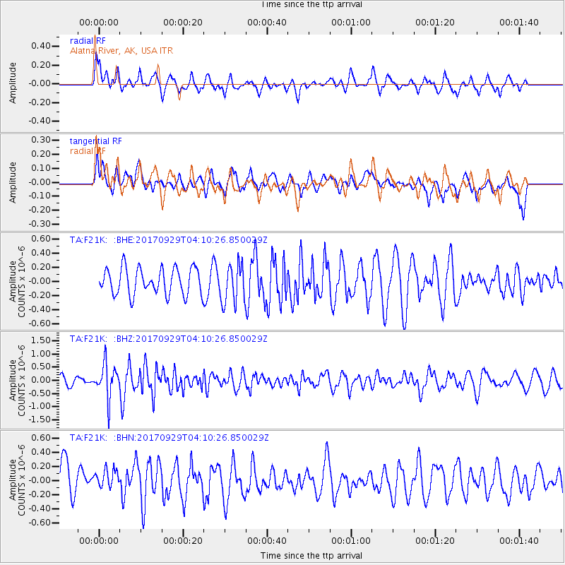
F21K Alatna River, AK, USA - Earthquake Result Viewer
*The percent match for this event was below the threshold and hence no stack was calculated.
| Earthquake location: |
Off Coast Of Chiapas, Mexico |
| Earthquake latitude/longitude: |
14.9/-94.0 |
| Earthquake time(UTC): |
2017/09/29 (272) 04:00:22 GMT |
| Earthquake Depth: |
22 km |
| Earthquake Magnitude: |
5.6 mb |
| Earthquake Catalog/Contributor: |
NEIC PDE/us |
|
| Network: |
TA USArray Transportable Network (new EarthScope stations) |
| Station: |
F21K Alatna River, AK, USA |
| Lat/Lon: |
67.22 N/153.48 W |
| Elevation: |
597 m |
|
| Distance: |
64.7 deg |
| Az: |
338.238 deg |
| Baz: |
112.996 deg |
| Ray Param: |
$rayparam |
*The percent match for this event was below the threshold and hence was not used in the summary stack. |
|
| Radial Match: |
60.284405 % |
| Radial Bump: |
400 |
| Transverse Match: |
46.40549 % |
| Transverse Bump: |
400 |
| SOD ConfigId: |
13570011 |
| Insert Time: |
2019-04-28 21:54:26.213 +0000 |
| GWidth: |
2.5 |
| Max Bumps: |
400 |
| Tol: |
0.001 |
|
Signal To Noise
| Channel | StoN | STA | LTA |
| TA:F21K: :BHZ:20170929T04:10:26.850029Z | 3.7567112 | 6.5972245E-7 | 1.756117E-7 |
| TA:F21K: :BHN:20170929T04:10:26.850029Z | 0.4724779 | 1.5580663E-7 | 3.297649E-7 |
| TA:F21K: :BHE:20170929T04:10:26.850029Z | 1.472485 | 2.8672588E-7 | 1.9472245E-7 |
| Arrivals |
| Ps | |
| PpPs | |
| PsPs/PpSs | |


