You are here: Home > Network List > TA - USArray Transportable Network (new EarthScope stations) Stations List
> Station H16K Elim, AK, USA > Earthquake Result Viewer
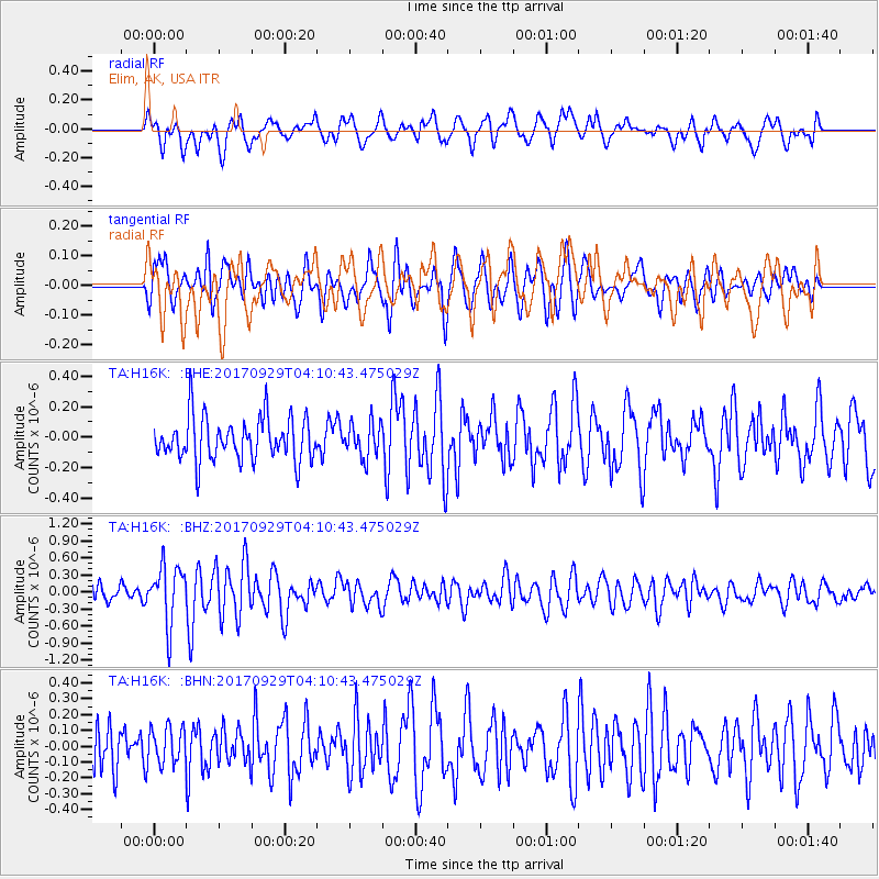
H16K Elim, AK, USA - Earthquake Result Viewer
*The percent match for this event was below the threshold and hence no stack was calculated.
| Earthquake location: |
Off Coast Of Chiapas, Mexico |
| Earthquake latitude/longitude: |
14.9/-94.0 |
| Earthquake time(UTC): |
2017/09/29 (272) 04:00:22 GMT |
| Earthquake Depth: |
22 km |
| Earthquake Magnitude: |
5.6 mb |
| Earthquake Catalog/Contributor: |
NEIC PDE/us |
|
| Network: |
TA USArray Transportable Network (new EarthScope stations) |
| Station: |
H16K Elim, AK, USA |
| Lat/Lon: |
64.64 N/162.24 W |
| Elevation: |
216 m |
|
| Distance: |
67.3 deg |
| Az: |
334.321 deg |
| Baz: |
103.413 deg |
| Ray Param: |
$rayparam |
*The percent match for this event was below the threshold and hence was not used in the summary stack. |
|
| Radial Match: |
60.300674 % |
| Radial Bump: |
400 |
| Transverse Match: |
70.860794 % |
| Transverse Bump: |
400 |
| SOD ConfigId: |
13570011 |
| Insert Time: |
2019-04-28 21:54:36.974 +0000 |
| GWidth: |
2.5 |
| Max Bumps: |
400 |
| Tol: |
0.001 |
|
Signal To Noise
| Channel | StoN | STA | LTA |
| TA:H16K: :BHZ:20170929T04:10:43.475029Z | 4.106851 | 5.1114915E-7 | 1.2446255E-7 |
| TA:H16K: :BHN:20170929T04:10:43.475029Z | 0.9023764 | 1.1720971E-7 | 1.2989004E-7 |
| TA:H16K: :BHE:20170929T04:10:43.475029Z | 1.0969787 | 1.5445531E-7 | 1.4080065E-7 |
| Arrivals |
| Ps | |
| PpPs | |
| PsPs/PpSs | |


