WPUT Wasatch Plateau, UT,USA - Earthquake Result Viewer
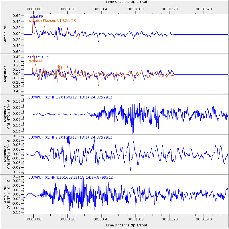
Earthquake location: Andreanof Islands, Aleutian Is.
Earthquake latitude/longitude: 51.6/-174.0
Earthquake time(UTC): 2016/03/12 (072) 18:06:45 GMT
Earthquake Depth: 19 km
Earthquake Magnitude: 6.3 MWW, 6.1 MB, 6.2 MWB, 6.3 MWC, 6.4 MWC, 6.4 MI
Earthquake Catalog/Contributor: NEIC PDE/NEIC COMCAT
Network: UU University of Utah Regional Network
Station: WPUT Wasatch Plateau, UT,USA
Lat/Lon: 39.00 N/111.36 W
Elevation: 2618 m
Distance: 44.5 deg
Az: 80.832 deg
Baz: 307.734 deg
Ray Param: 0.071841136
Estimated Moho Depth: 64.25 km
Estimated Crust Vp/Vs: 1.90
Assumed Crust Vp: 6.207 km/s
Estimated Crust Vs: 3.258 km/s
Estimated Crust Poisson's Ratio: 0.31
Radial Match: 86.74365 %
Radial Bump: 400
Transverse Match: 65.39986 %
Transverse Bump: 400
SOD ConfigId: 1453031
Insert Time: 2016-03-26 18:41:39.971 +0000
GWidth: 2.5
Max Bumps: 400
Tol: 0.001

Signal To Noise

ChannelStoNSTALTA
UU:WPUT:01:HHZ:20160312T18:14:24.879991Z3.21139121.3012878E-84.0521E-9
UU:WPUT:01:HHN:20160312T18:14:24.879991Z0.97001627.190813E-97.4130857E-9
UU:WPUT:01:HHE:20160312T18:14:24.879991Z1.74984438.200932E-94.6866644E-9
Arrivals
Ps9.9 SECOND
PpPs28 SECOND
PsPs/PpSs38 SECOND