You are here: Home > Network List > AK - Alaska Regional Network Stations List
> Station CUT Chulitna, AK, USA > Earthquake Result Viewer
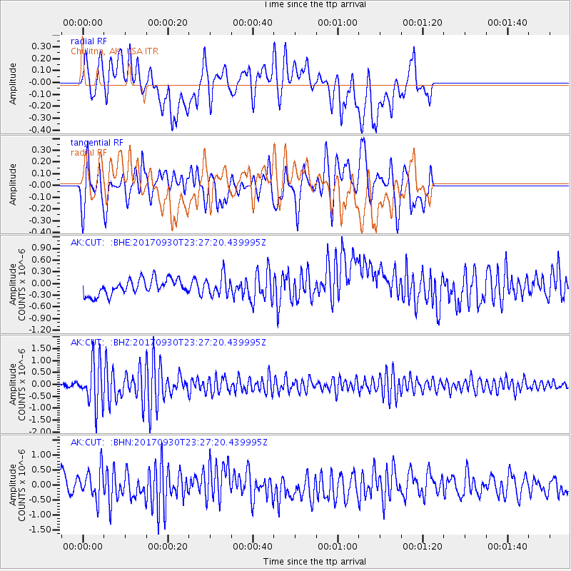
CUT Chulitna, AK, USA - Earthquake Result Viewer
*The percent match for this event was below the threshold and hence no stack was calculated.
| Earthquake location: |
North Of Halmahera, Indonesia |
| Earthquake latitude/longitude: |
3.9/128.5 |
| Earthquake time(UTC): |
2017/09/30 (273) 23:15:29 GMT |
| Earthquake Depth: |
10 km |
| Earthquake Magnitude: |
5.5 Mww |
| Earthquake Catalog/Contributor: |
NEIC PDE/us |
|
| Network: |
AK Alaska Regional Network |
| Station: |
CUT Chulitna, AK, USA |
| Lat/Lon: |
62.41 N/150.26 W |
| Elevation: |
574 m |
|
| Distance: |
82.4 deg |
| Az: |
27.658 deg |
| Baz: |
264.015 deg |
| Ray Param: |
$rayparam |
*The percent match for this event was below the threshold and hence was not used in the summary stack. |
|
| Radial Match: |
46.65844 % |
| Radial Bump: |
400 |
| Transverse Match: |
61.332054 % |
| Transverse Bump: |
400 |
| SOD ConfigId: |
13570011 |
| Insert Time: |
2019-04-28 22:02:05.025 +0000 |
| GWidth: |
2.5 |
| Max Bumps: |
400 |
| Tol: |
0.001 |
|
Signal To Noise
| Channel | StoN | STA | LTA |
| AK:CUT: :BHZ:20170930T23:27:20.439995Z | 8.219887 | 9.437322E-7 | 1.1481085E-7 |
| AK:CUT: :BHN:20170930T23:27:20.439995Z | 2.1282265 | 5.057802E-7 | 2.3765334E-7 |
| AK:CUT: :BHE:20170930T23:27:20.439995Z | 1.2699128 | 2.533431E-7 | 1.9949645E-7 |
| Arrivals |
| Ps | |
| PpPs | |
| PsPs/PpSs | |


