You are here: Home > Network List > TA - USArray Transportable Network (new EarthScope stations) Stations List
> Station J20K Nowitna River, AK, USA > Earthquake Result Viewer
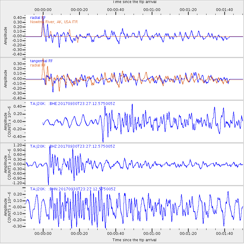
J20K Nowitna River, AK, USA - Earthquake Result Viewer
*The percent match for this event was below the threshold and hence no stack was calculated.
| Earthquake location: |
North Of Halmahera, Indonesia |
| Earthquake latitude/longitude: |
3.9/128.5 |
| Earthquake time(UTC): |
2017/09/30 (273) 23:15:29 GMT |
| Earthquake Depth: |
10 km |
| Earthquake Magnitude: |
5.5 Mww |
| Earthquake Catalog/Contributor: |
NEIC PDE/us |
|
| Network: |
TA USArray Transportable Network (new EarthScope stations) |
| Station: |
J20K Nowitna River, AK, USA |
| Lat/Lon: |
64.18 N/154.15 W |
| Elevation: |
314 m |
|
| Distance: |
80.9 deg |
| Az: |
25.637 deg |
| Baz: |
260.257 deg |
| Ray Param: |
$rayparam |
*The percent match for this event was below the threshold and hence was not used in the summary stack. |
|
| Radial Match: |
71.376305 % |
| Radial Bump: |
400 |
| Transverse Match: |
71.727974 % |
| Transverse Bump: |
384 |
| SOD ConfigId: |
13570011 |
| Insert Time: |
2019-04-28 22:05:31.925 +0000 |
| GWidth: |
2.5 |
| Max Bumps: |
400 |
| Tol: |
0.001 |
|
Signal To Noise
| Channel | StoN | STA | LTA |
| TA:J20K: :BHZ:20170930T23:27:12.575005Z | 7.8091917 | 4.6431867E-7 | 5.9457967E-8 |
| TA:J20K: :BHN:20170930T23:27:12.575005Z | 1.3892465 | 1.1054973E-7 | 7.957532E-8 |
| TA:J20K: :BHE:20170930T23:27:12.575005Z | 2.7911627 | 2.1649741E-7 | 7.756531E-8 |
| Arrivals |
| Ps | |
| PpPs | |
| PsPs/PpSs | |


