You are here: Home > Network List > MN - MEDNET Project Stations List
> Station VTS Vitosha, Bulgary > Earthquake Result Viewer
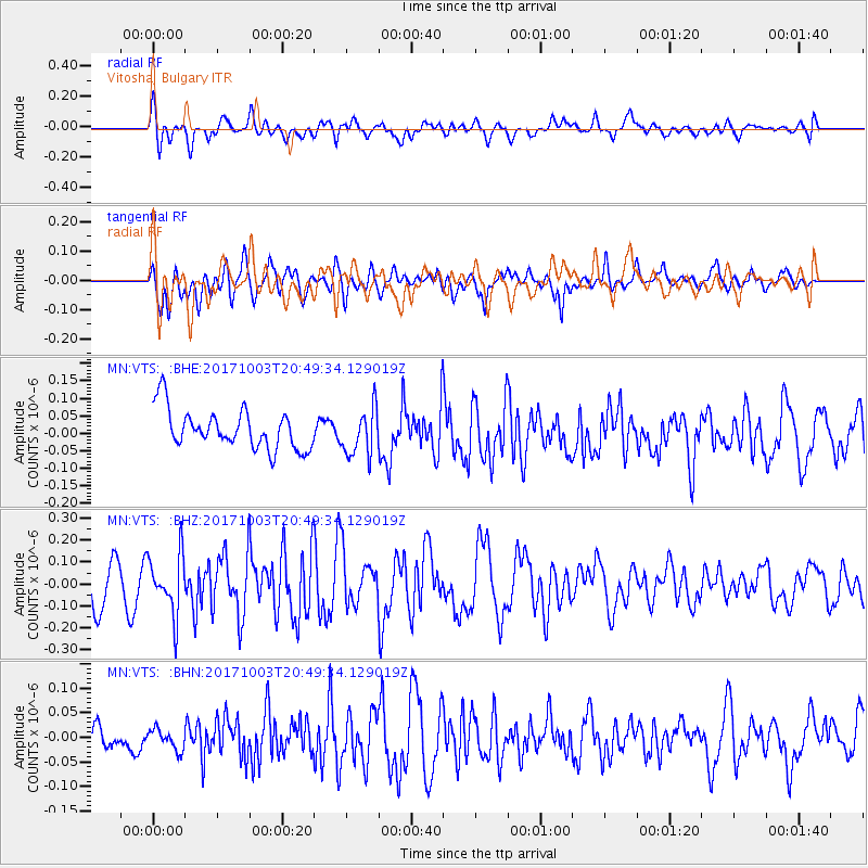
VTS Vitosha, Bulgary - Earthquake Result Viewer
*The percent match for this event was below the threshold and hence no stack was calculated.
| Earthquake location: |
North Atlantic Ocean |
| Earthquake latitude/longitude: |
13.5/-49.3 |
| Earthquake time(UTC): |
2017/10/03 (276) 20:39:04 GMT |
| Earthquake Depth: |
10 km |
| Earthquake Magnitude: |
5.7 Mww |
| Earthquake Catalog/Contributor: |
NEIC PDE/us |
|
| Network: |
MN MEDNET Project |
| Station: |
VTS Vitosha, Bulgary |
| Lat/Lon: |
42.62 N/23.24 E |
| Elevation: |
1490 m |
|
| Distance: |
68.2 deg |
| Az: |
49.324 deg |
| Baz: |
268.389 deg |
| Ray Param: |
$rayparam |
*The percent match for this event was below the threshold and hence was not used in the summary stack. |
|
| Radial Match: |
55.69633 % |
| Radial Bump: |
400 |
| Transverse Match: |
60.909584 % |
| Transverse Bump: |
400 |
| SOD ConfigId: |
13570011 |
| Insert Time: |
2019-04-28 22:10:34.812 +0000 |
| GWidth: |
2.5 |
| Max Bumps: |
400 |
| Tol: |
0.001 |
|
Signal To Noise
| Channel | StoN | STA | LTA |
| MN:VTS: :BHZ:20171003T20:49:34.129019Z | 1.6115744 | 1.3502162E-7 | 8.378243E-8 |
| MN:VTS: :BHN:20171003T20:49:34.129019Z | 0.4983077 | 2.3471566E-8 | 4.7102553E-8 |
| MN:VTS: :BHE:20171003T20:49:34.129019Z | 1.192571 | 6.729E-8 | 5.6424312E-8 |
| Arrivals |
| Ps | |
| PpPs | |
| PsPs/PpSs | |


