You are here: Home > Network List > G - GEOSCOPE Stations List
> Station MBO M'Bour, Senegal > Earthquake Result Viewer
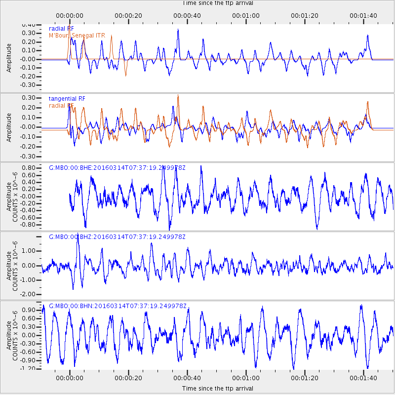
MBO M'Bour, Senegal - Earthquake Result Viewer
*The percent match for this event was below the threshold and hence no stack was calculated.
| Earthquake location: |
South Sandwich Islands Region |
| Earthquake latitude/longitude: |
-56.4/-27.1 |
| Earthquake time(UTC): |
2016/03/14 (074) 07:26:43 GMT |
| Earthquake Depth: |
104 km |
| Earthquake Magnitude: |
5.7 MB |
| Earthquake Catalog/Contributor: |
NEIC PDE/NEIC COMCAT |
|
| Network: |
G GEOSCOPE |
| Station: |
MBO M'Bour, Senegal |
| Lat/Lon: |
14.39 N/16.95 W |
| Elevation: |
3.0 m |
|
| Distance: |
71.1 deg |
| Az: |
10.392 deg |
| Baz: |
185.934 deg |
| Ray Param: |
$rayparam |
*The percent match for this event was below the threshold and hence was not used in the summary stack. |
|
| Radial Match: |
59.98719 % |
| Radial Bump: |
400 |
| Transverse Match: |
63.404377 % |
| Transverse Bump: |
400 |
| SOD ConfigId: |
1453031 |
| Insert Time: |
2016-03-28 07:41:26.776 +0000 |
| GWidth: |
2.5 |
| Max Bumps: |
400 |
| Tol: |
0.001 |
|
Signal To Noise
| Channel | StoN | STA | LTA |
| G:MBO:00:BHZ:20160314T07:37:19.249978Z | 2.201326 | 9.652845E-7 | 4.385014E-7 |
| G:MBO:00:BHN:20160314T07:37:19.249978Z | 1.019056 | 5.6342503E-7 | 5.528892E-7 |
| G:MBO:00:BHE:20160314T07:37:19.249978Z | 1.8608946 | 5.2298265E-7 | 2.810383E-7 |
| Arrivals |
| Ps | |
| PpPs | |
| PsPs/PpSs | |


